Why Treks in Uttarakhand, Himachal Pradesh, Jammu & Kashmir are so...
Share this story
Why Treks in Uttarakhand, Himachal Pradesh, Jammu & Kashmir are so different
Category Guides To Choose Treks On Himalayan Treks Expert Opinion
By Latika Payak
2021-04-08
We all have biases when it comes to picking a favourite state for trekking.
Lakshmi Selvakumaran, Head of Learning and Development at Indiahikes, shares an interesting thought with me. “I am biased towards the treks of Himachal Pradesh,” she says while describing the lush valleys, and towering mountains of the state. “You also don’t find the contrasting landscape — like the green Kinnaur and desert Spiti — in any other state in India,” she adds.
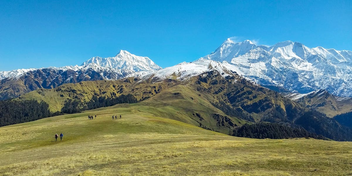
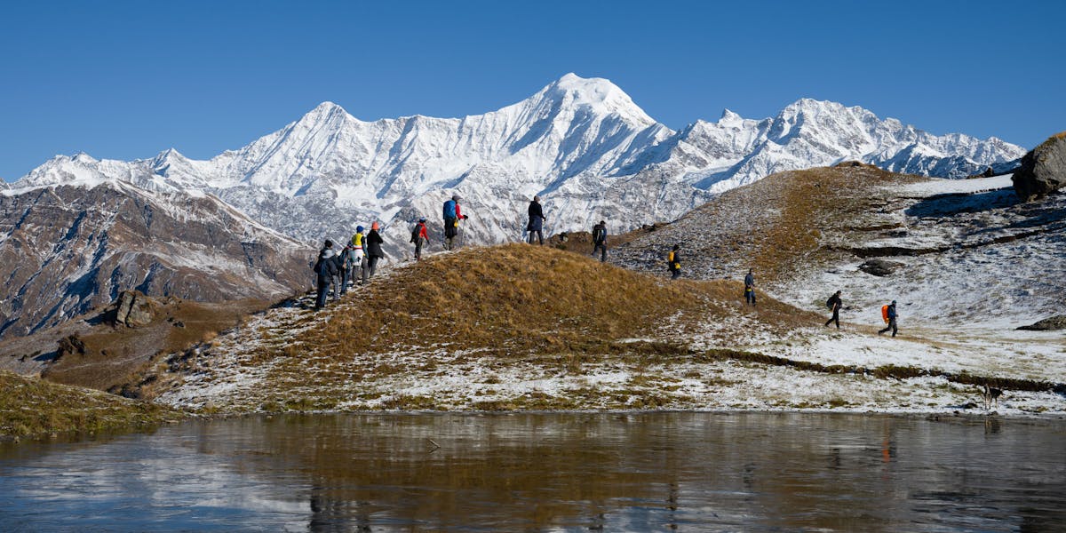
For Sandhya UC, co-founder of Indiahikes, it’s Uttarakhand. “What you get in Uttarakhand, you don’t get anywhere in the world,” she says while pointing at the jaw-dropping view of Mt Trishul from Bedni Bugyal. “Such views are visible only from treks in Uttarakhand,” she says.
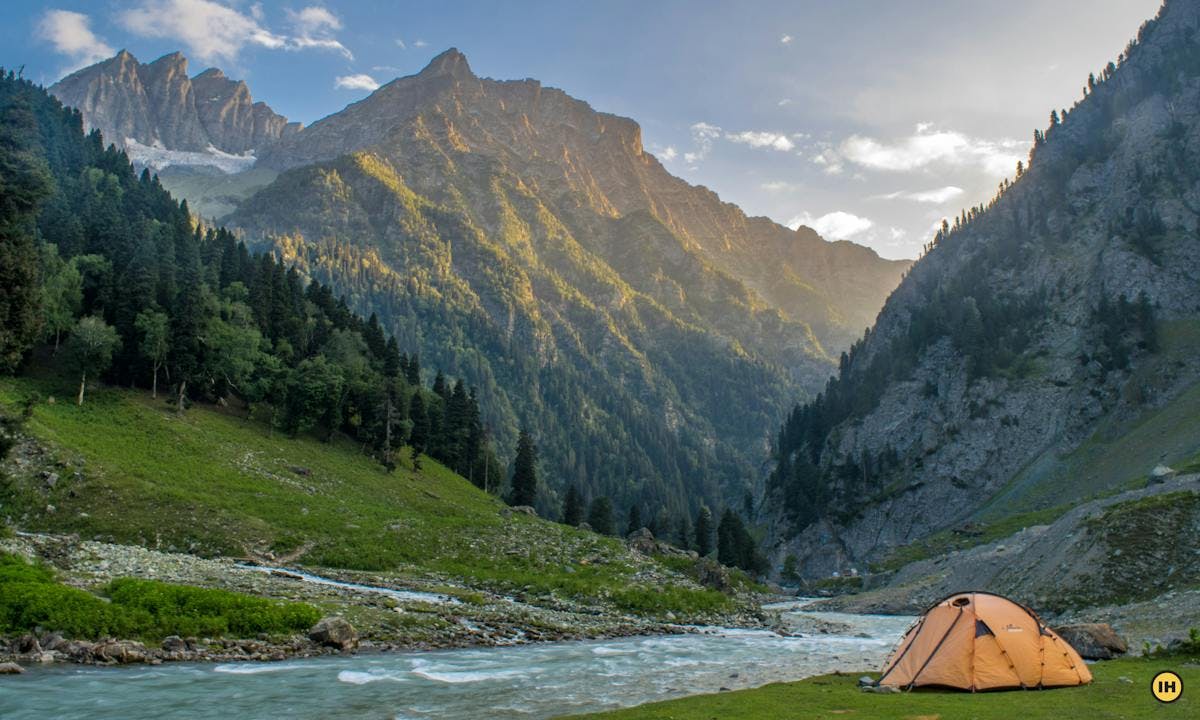
After I did the picturesque Tarsar Marsar trek, my personal bias leaned towards Kashmir. With poplars, willows, and chinars bordering its vast grasslands, I felt Kashmir had the most charming tree line. No other state could look so picture-perfect, so manicured.
These biases bring out the differences in each state. But do we celebrate these differences? Do we even know why these differences exist?
For a long time I thought I knew; but then I realised I didn’t know much.
A conversation with Arjun Majumdar, the founder of Indiahikes, stumped me. “The differences are not entirely because of the mountain ranges in each state,” he said. What, really?
Latitudes — they make all the difference
Arjun explained, “The latitude of a region determines the angle at which it receives sunlight. That, in turn, affects the flora, fauna, and snow of the region.”
This quick lesson in geography brought back memories of school days. I hadn’t anticipated the powerful role of latitude as we moved from one state to another.
Instantly, scenes from the Tarsar Marsar trek flashed across my mind. The landscape in Kashmir looks different from the rest of the country.
This was because of its latitude.
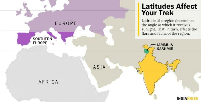
If you observe the latitudes on the world map, you notice that the latitude running through Kashmir is not too far away from that of Southern Europe.
Even though in plain sight, this reason was a revelation.
Look out for the changing flora brought about by the change in latitude
In Kashmir, the temperate deciduous forests swiftly give way to alpine meadows. This gives a European feel to the landscape.
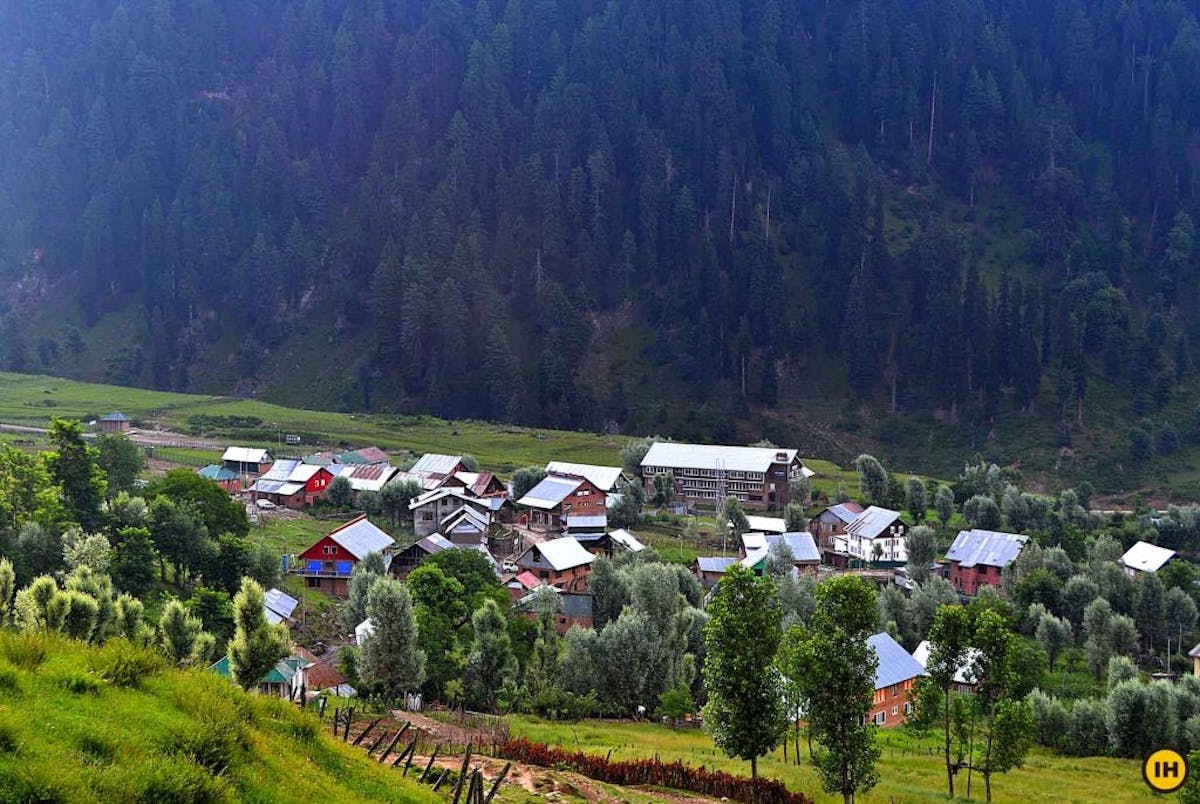
The willow and poplar trees at Aru, the start point of the Tarsar Marsar Trek. Photo by Arjun Majumdar
Dark, silent forests or forests blooming with rhododendrons are found mostly in Uttarakhand. This is the zone for tropical deciduous trees. Unlike the forests in Kashmir, these forests don’t lose their leaves in winter.
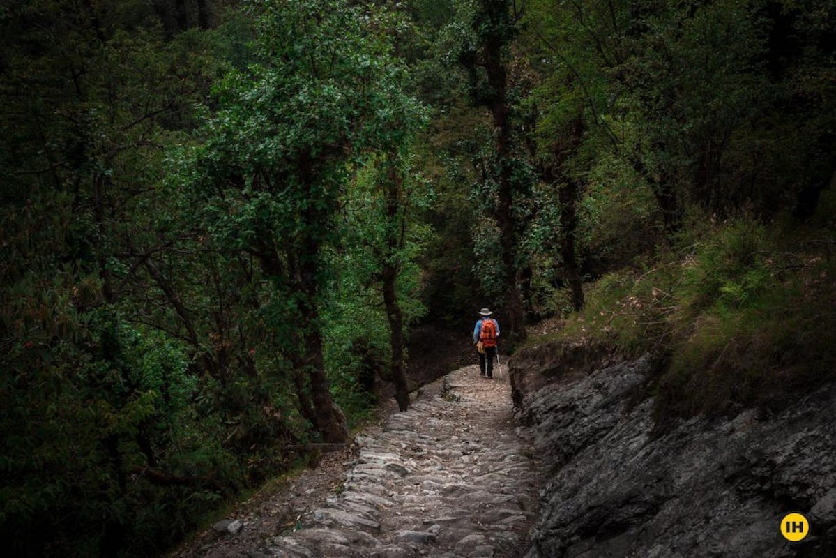
A section of the dark oak forest on the Ali Bedni Bugyal trek in Uttarakhand. These forests are rare in Himachal or Kashmir. Photo by Atish Waghwase
Similarly, Himachal Pradesh is well-known for dry, deciduous trees, orchards with apple trees drooping under their own weight.
Snow on the trek affected by latitudes
Apart from the flora, the presence of snow also separates one state from another.
Uttarakhand, being closest to the equator among the three states, has the shortest season of snow. It starts from mid-December and soon melts away by mid-April.
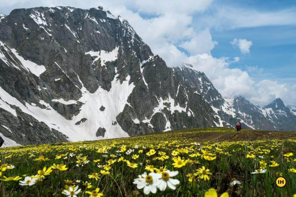
But snow takes longer to melt when you move northwards. This is why you find big patches of snow on our Bhrigu lake trek even in June.
This picture of snow patches around the Bhrigu Lake was taken in late June. Photo by Anirban Ray
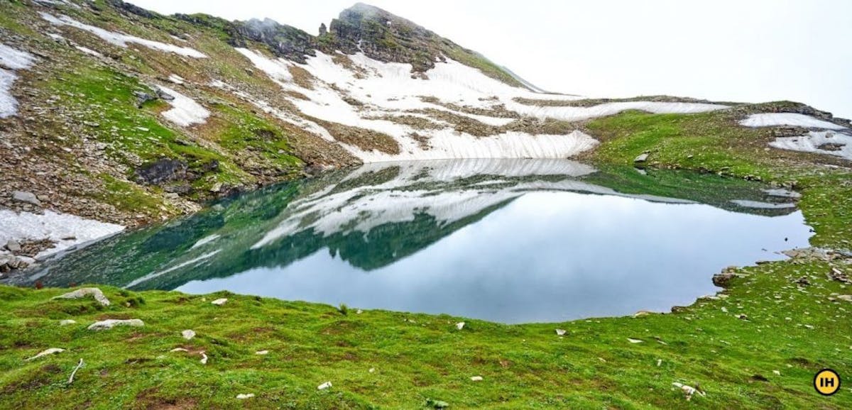
As you move further up, to Kashmir, snow starts melting only by July. Throughout the year, at around 14,000 ft, when snow has melted in all other states, traces of snow remain in Kashmir.
Even as flowers bloom in the valley in July, patches of snow remain on the Kashmir Great Lakes trek. Photo by Krunal Patel
That’s the role of latitude in defining your trek experience. Latitude decides when you get to trek in a particular state.
But mountain ranges play a part too.
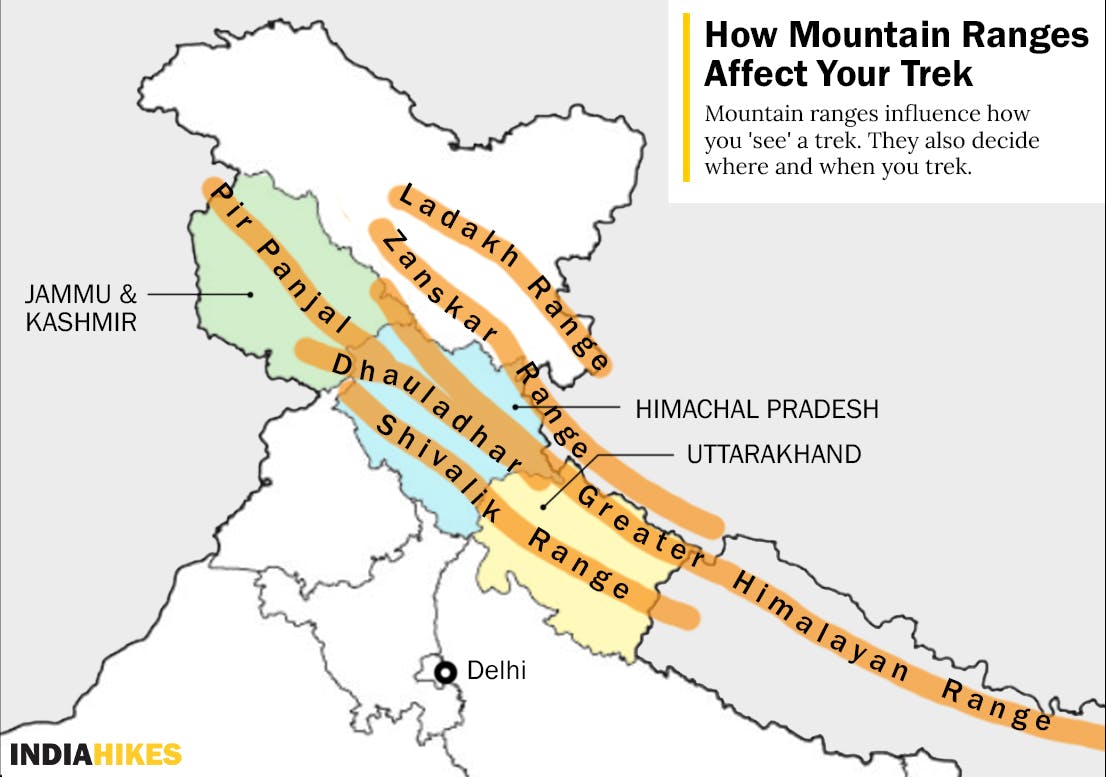
How Mountain Ranges Affect Your Trek
The Himalayas are made up of different ranges.
Tanmay Bain
Senior Trek Leader
Around 50 million years ago, when the Eurasian tectonic plate collided with the Indian tectonic plate, the region of Uttarakhand experienced major crumpling of the landscape. This formed the Greater Himalayas.
This is why valleys are narrow and mountains are higher in Uttarakhand. The folds became gentler as we moved towards Kashmir, giving way to wider valleys and lower mountains.
In Uttarakhand, you see mountains rising in the Garhwal and Kumaon Himalayas.
In Himachal Pradesh, you have the Kangra valley at the foot of the Dhauladhar range. You also have the Pir Panjal and Zanskar range in Himachal.
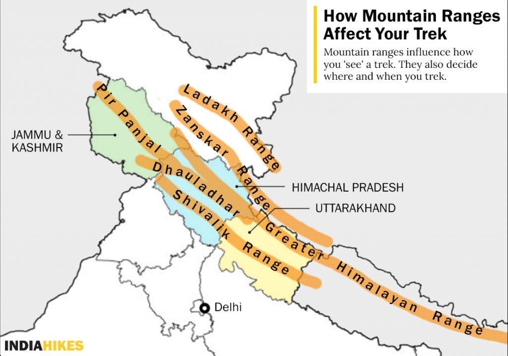
The Pir Panjal range divides Kashmir valley from Jammu. It continues towards Pakistan as the Karakoram range with one end touching Mt. Harmukh on the Kashmir Great Lakes trek.
Mountain ranges largely influence how you ‘see’ a trek.
Mountain Ranges Influence the Monsoons
Most Uttarakhand treks – except Valley of Flowers – shut down from July to September. During those months, Uttarakhand receives heavy rains from the southwest monsoons.
But it is very different in Himachal Pradesh and Kashmir. The effect of the southwest monsoon reduces beyond the Outer Himalayas. Instead, in those regions, the Western Disturbances rising from the Mediterranean sea cause snowfall in winter.
Swathi Chatrapathy, Chief Editor at Indiahikes, details the reason in her blog – Treks To Do (And Not To Do) in Monsoon.
Swathi Chatrapathy
Chief Editor
During Southwest monsoons in our country, moisture-laden winds blow from the South to the North. But the Himalayas act as a big barrier to these winds. They do not let the winds pass. As these clouds hit this barrier, they burst and come down as rain on the southern side of the mountain. The other side of the barrier doesn’t receive any rain, so it remains barren and desert-like, creating the rain-shadow regions of our country.
Dramatic Changes in Landscape
The change in precipitation caused by mountain ranges also impacts the landscape of a state.
The lush side of the Pin Bhaba Pass trek. The next day you are in a 100 percent contrasting landscape that is hard to believe. Picture by Abhishek T S
A beautiful example of this is created by the Zanskar range in Himachal Pradesh. It divides Kinnaur valley from Spiti and creates a dramatic shift in landscape as you cross the Pin Bhaba pass. During the course of the trek, you leave the lush green of Kinnaur to step into the stark deserts of Spiti.
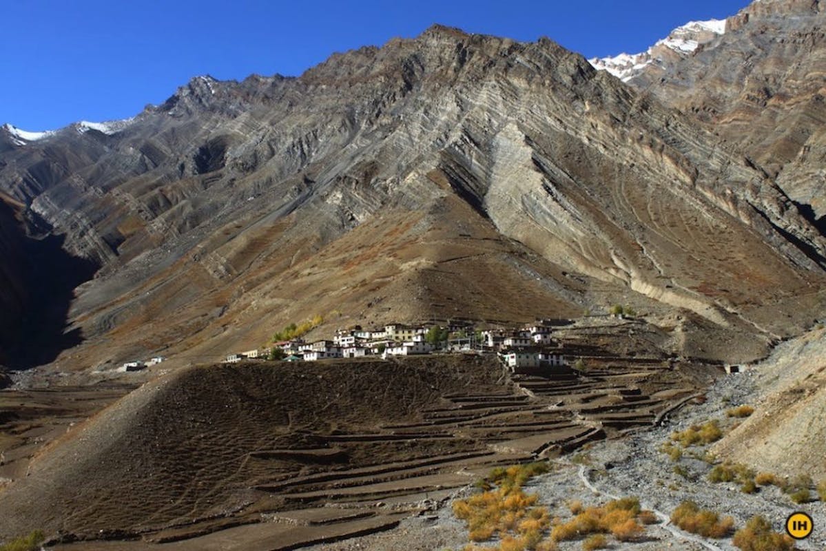
The desert side of the Pin Bhaba pass trek. The village of Mudh from the trail. Photo by Jitendra Tanna
Monsoon, influenced by the mountain ranges, determines ‘when’ you trek. But there’s more.
Proximity to the Mountains Alters your Trek Experience
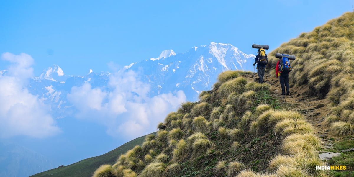
When our co-founder Sandhya spoke about jaw-dropping views, she was describing something very typical to the treks of Uttarakhand – the commanding views of the Garhwal Himalayas from vantage points. No other state has vantage points from where you can see some of the grandest peaks of India.
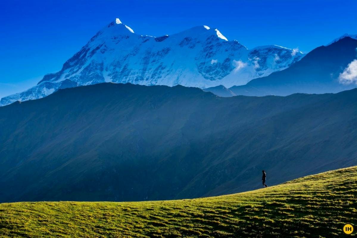
Mt. Trishul of the Garhwal Himalayas towers over the Bedni Bugyal. Such commanding views are characteristic of Uttarakhand treks. Photo by Sudipto
But the experience of seeing a peak is different in Himachal Pradesh and Kashmir. Even though the mountains are not as tall as in the Garhwal Himalayas, they can appear grander from Himachal and Kashmir.
Lakshmi Selvakumaran
Head of Experience
The valleys are much wider and the mountains look much bigger in Himachal. That’s probably because they are closer than on the Uttarakhand treks. Even the drive to the basecamps, be it to Jobra of Hampta Pass, Solang Valley of Beas Kund or Gulaba of Bhrigu Lake are scenic because you are going through roads winding between these tall mountains and wide valleys
.
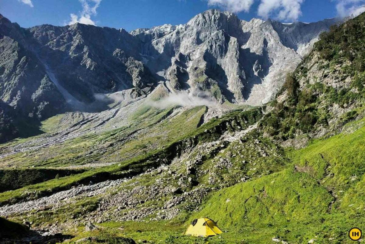
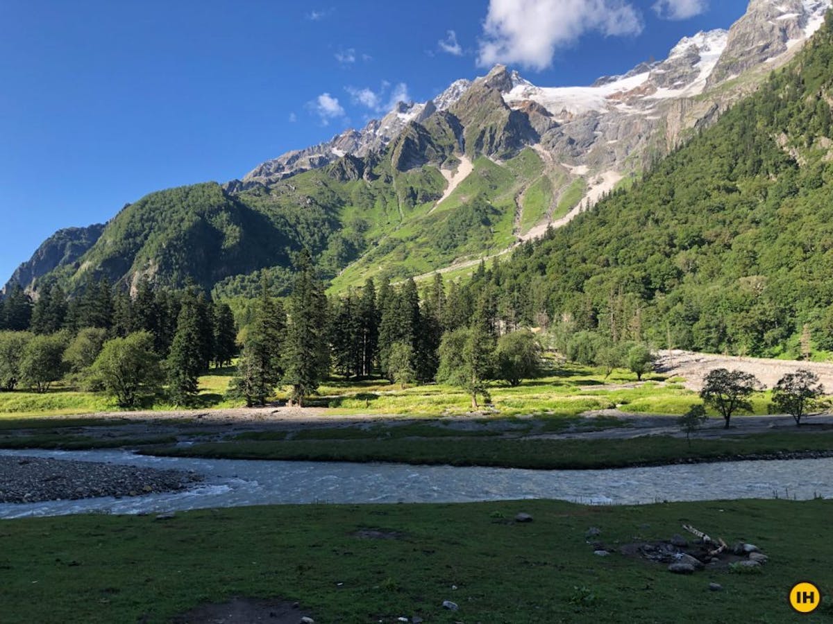
The base to summit view of Pir Panjal range from Lohali, a campsite on the Beas Kund trek. Photo by Akhil Menon.
On the Beas Kund trek, you camp right at the foot of the Pir Panjal range. The jagged Friendship Peak and Hanuman Tibba rise from base to top right in front of you. Nowhere in Uttarakhand do you get to see this experience.
A view of Thajiwas glacier from Shitkadi, the basecamp of Kashmir Great Lakes trek. Photo by Nimesh Mittal
In Kashmir, as you reach Shitkadi, the basecamp of Kashmir Great Lakes trek, the Thajiwas glacier is right in front of you. You even camp near Mt. Harmukh, a mountain towering over Gangabal lake, on the fifth day of your trek.
| Interesting Side-note: Mt Harmukh touches the border of the daunting Karakoram range, which starts in Kashmir, goes into Pakistan and then into Afghanistan as the Hindu-Kush range. That’s the role mountain ranges play.
When is the Best Time to Trek
Here, I would like to stress upon a point that many trekkers overlook – the choice of a trek doesn’t depend on the altitude or difficulty.
While choosing a trek, zoom out a little. Notice the location of the state. Observe its topography. Pay attention to the wildlife – flora, and fauna. Find out what sets this trek apart from others.
Then, focus on the best season to do the trek. Know the ‘why’ of the trek before you get to the ‘how’.
I’ve made a table here for you that will help you decide quickly.
| State | Treks | Best Time |
| Uttarakhand | Dayara Bugyal, Deoriatal, Brahmatal, Kedarkantha, Kuari Pass | All year round except monsoon |
| Phulara Ridge, Rupin Pass, Gaumukh Tapovan, Kedartal, Gidara Bugyal | Summer and autumn | |
| Valley of Flowers | Monsoon | |
| Himachal Pradesh | Hampta Pass, Beas Kund, Bhrigu Lake, Pin Bhaba Pass | Monsoon |
| Buran Ghati | Summer and autumn | |
| Kashmir | Kashmir Great Lakes, Tarsar Marsar | Monsoon |
Conclusion
That brings me to the end of my study on the differences between trekking in Uttarakhand, Himachal Pradesh, and Jammu & Kashmir. There’s a lot more to cover if we deep dive into this topic, which I’ll save for another day.
But as you can see, the mountain ranges and latitudes have a huge role to play in how the landscapes and terrain affect your trek. They also decide the trekking seasons of each state.
This is why we advise our trekkers to choose treks based on the region and season, not the altitude or difficulty. This changes how you approach a trek. It’s not about getting to the highest altitude, it’s about exploring a space that you won’t find anywhere else.
If you have any other differences you have observed while trekking in these regions, drop in a comment below. Trekkers would love to read about them.
Happy trekking!
Latika Payak
Senior Content Writer
About the author
Latika is a Senior Content Writer and one of the rare team members who has seen Indiahikes from its initial days. She was among the first few to begin creating content at Indiahikes, documenting treks around Maharasthra, interviewing trekkers and writing their stories.
Latika started trekking after joining Indiahikes and has trekked to Roopkund, Hampta Pass, Kedarkantha, Dayara Bugyal, Tarsar Marsar, and Har Ki Dun.
With a strong background in print media and have worked with several publications. Latika is always hunting for great stories hidden in the folds of the mountains. Horror stories from ancient routes and villages of the Himalayas are her favourite.
She is presently working on bringing out news from the remote trekking regions of our country.
Sign up for our much loved Weekly Mailer
We have terrific trekking tips, trek updates and trek talks to look forward to