Can You Help Us With Photographs Of This Trek?
We are looking to enrich this documentation with more photos. Pictures go a long way in explaining the trail, more than words ever can. If you have done this trek, can you share your photos with us? We will include them on this page, with due credit to you. Click here to contribute.
The Complete Guide to Devkund Waterfall Trek
Devkund waterfall is a secluded little place situated deep inside the forests surrounding the Bhira dam. There is a hydroelectric power generation unit by Tata power at Bhira. This place was little known to trekkers till recent times and has come into the limelight due to the waterfall present deep inside the forest.
It is believed that the Kundalika river originates at Devkund.
Though there isn’t much history associated with the falls, locals here believe that once upon a time utensils used to emerge from the Kund (pond) whenever there was any auspicious ceremony happening in the local village.
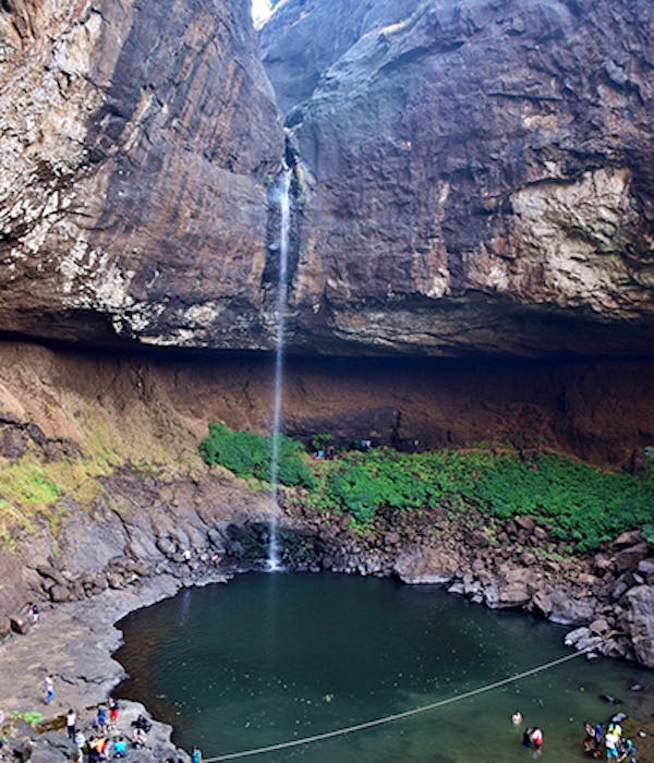
True or not, the place has its charm with the water dropping from a height of over 80 ft straight into a pond of approx. 30 mt diameter.
➤ Highlights of the trek
- Easy trek through dense forest, which brings you to the base of Devkund waterfall
- Option to camp along the waters of the Bhira reservoir
➤ Trek Details
- Altitude: 2,000 ft
- Time took: 1.5 hours each way
- Trek gradient: Easy. Flat walk with a few, short stretches of gradual ascent.
- Water sources: None. Carry two litres of water
The trail begins from the open parking area at Bhira. It is a well-laid path with direction boards at regular intervals. Unlike common belief, the chances of getting lost in the forest are almost nil. The trail is better laid than a few famous treks in Maharashtra.
For the first 30 minutes, the trail goes alongside the Bhira dam reservoir. In case you wish to stay overnight, this is a good place to set up camp as camping is not allowed near the waterfalls. The backdrop of the reservoir makes this a perfect camping location.
A slight descent from here will take you along the banks of the reservoir from where the trail advances further into the forest. In the first 45 mins, you have to cross 2 dried up streams separated by a distance of around 20 mins. The terrain is a mix of open meadows and overgrowth.
After this, the trail starts climbing for around minutes. Though the climb isn’t steep, a good amount of energy is required. You may find small huts selling tea, lemon juice and snacks along the way. This climb is through dense forest, hence little care needs to be taken while manoeuvring through the branches.
Post the completion of the climb, the trail opens up to a rocky patch. A 10 min walk through the rocks brings you directly in front of the waterfall.
Locals have marked a line of control bisecting the pond. Swimming in the first half of the bisection is allowed. No one is allowed to go to the point where the water hits the ground as the depth over there is around 60 feet and there have been incidences of visitors drowning in it.
October to mid-November would be the best time to experience the falls if one needs to click better pictures.
The trek is closed from July to September for tourists when the rain is at its peak.
Points to note:
- Lunch/Dinner is available at the base village. Small huts offering tea, lemon juice, and chips are found on the way.
- Camping near the waterfall is not allowed. However, you can camp near the reservoir. Also, you can stay at Bhira village.
- Villagers have set up a registration desk at the beginning of the trail. You need to hire a local guide here. Although no guide is required for the trail, the people at the registration desk insist you on taking a guide (the recent popularity of this place may have made them realize that this can be a source of income).
- There is a parking fee of INR 50. Guides charge INR 50 per head. Entry check post by Bhira Grampanchayat charge os INR 10 per person (kaccha receipts given).
➤ How to reach the base of the Devkund Waterfall trek
The base village to reach Devkund waterfall is Bhira. This is located 26 km from Pali village (famous for the Ballaleshwar Ganpati temple). There are two options to reach Pali.
The first option is to take the direct state transport bus from Panvel depot to Pali while the second option is to get down at Vakan (all buses going to Mahad and beyond via Mumbai Goa highway stop at Vakan). From Vakan, there are shared autos that take you to Pali. Autos charge INR 20-25 per person and take around 30 minutes to reach Pali. State transport buses from Pali to Bhira are also available but the frequency is very less. So the best way to travel is by personal or hired vehicle.
For travellers from Mumbai, the recommended route would be:
Mumbai-Chembur-Vashi-Pune expressway-Khalapur-Pali-Bhira.
For travellers from Pune, the recommended route would be:
Pune-Kothrud-Bhugaon-Pirangut-Mulshi-Tamhini Ghat-Bhira
➤ Gallery
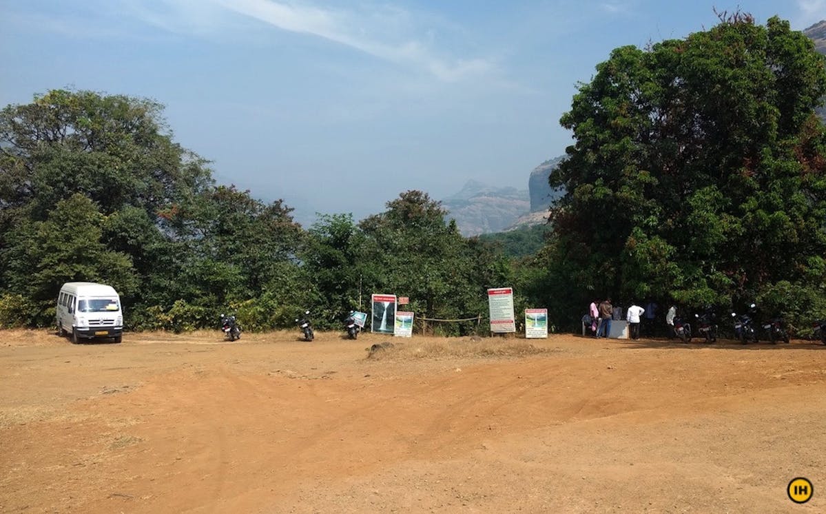
Starting point of the trek from Bhira village PC: Apoorva Karlekar
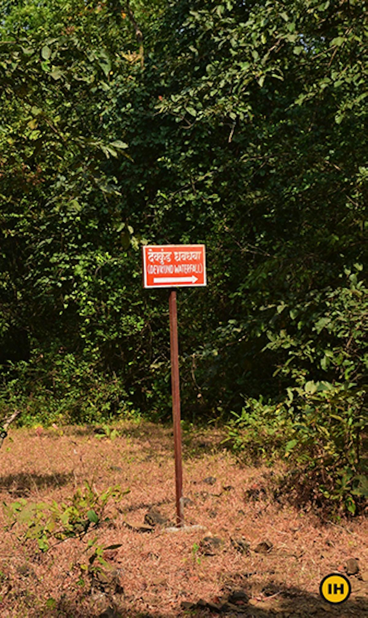
The trail is well marked and there are boards with directions PC: Apoorva Karlekar
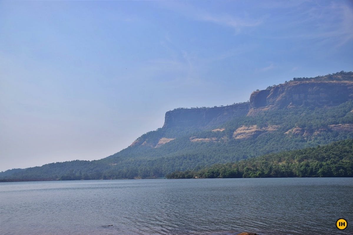
Bhira Dam reservoir PC: Apoorva Karlekar
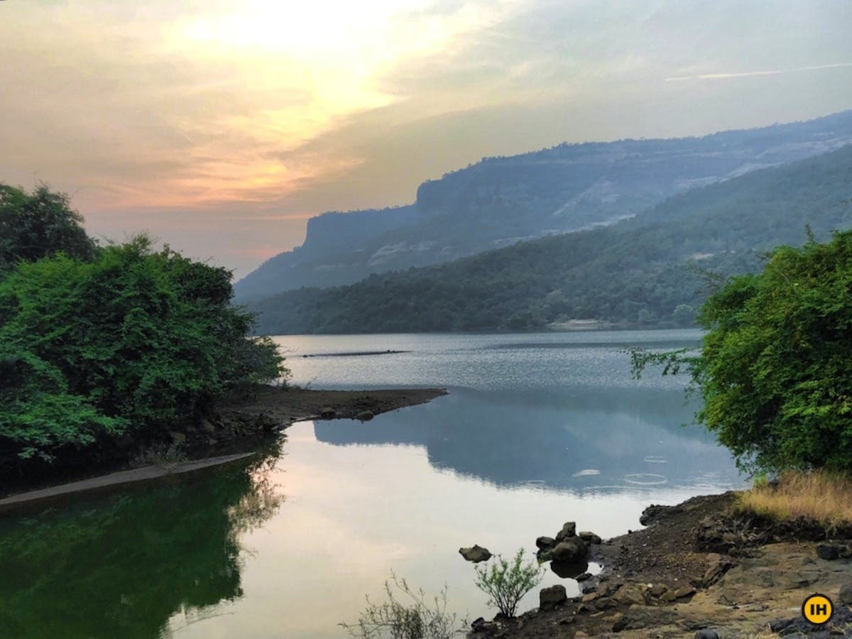
A view of Bhira backwaters PC: Apoorva Karlekar
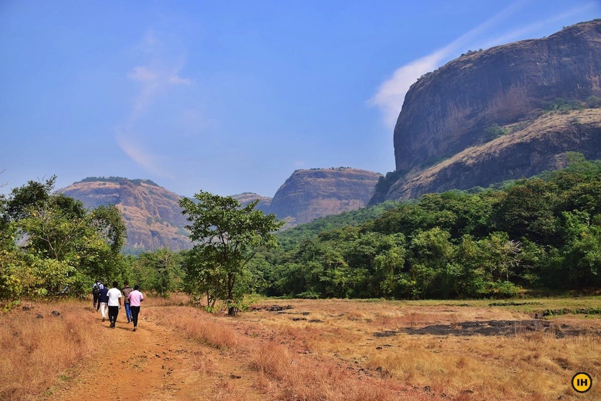
Open meadows during the first half of the trek PC: Apoorva Karlekar
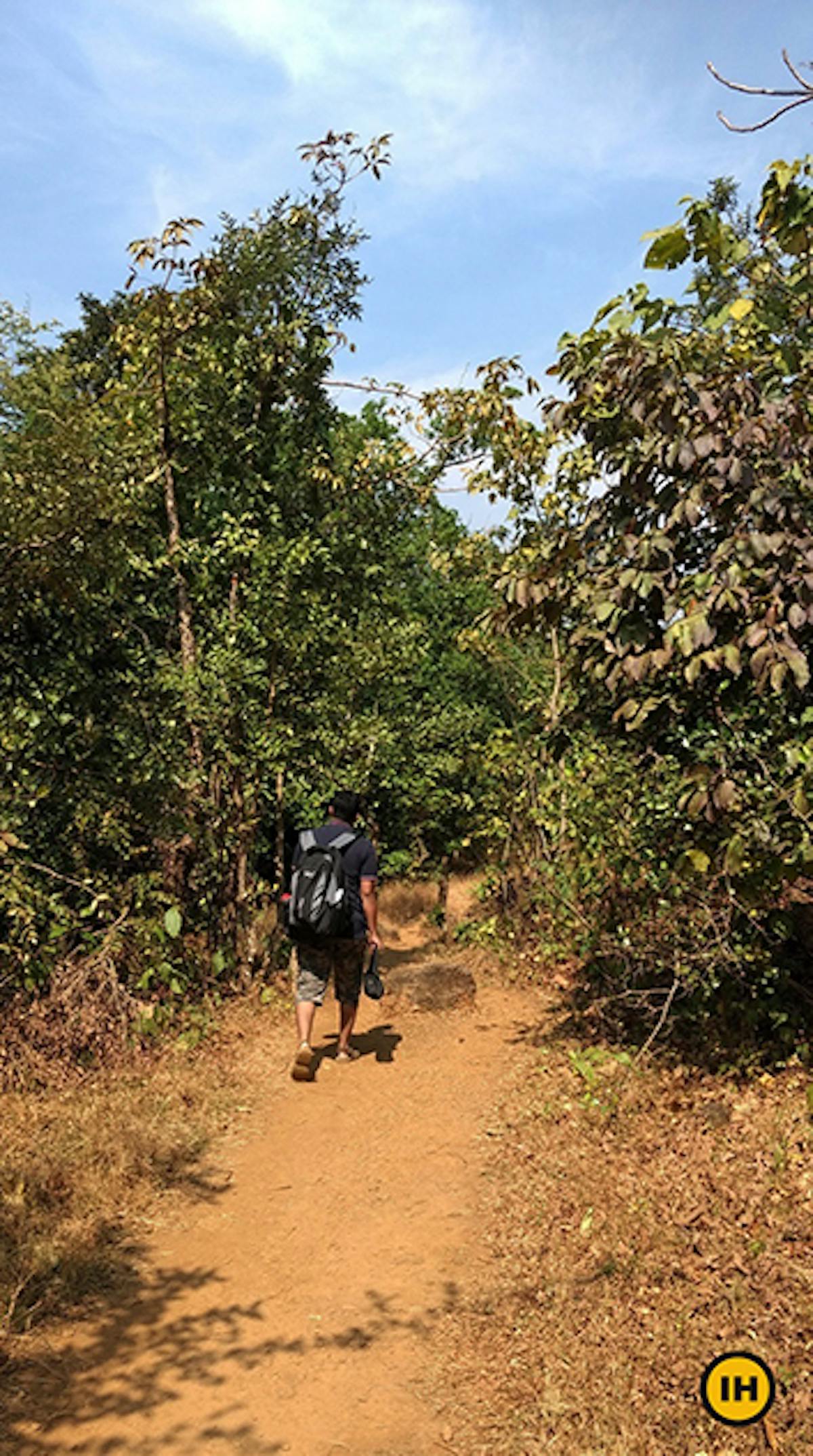
Trail through vegetation PC: Apoorva Karlekar
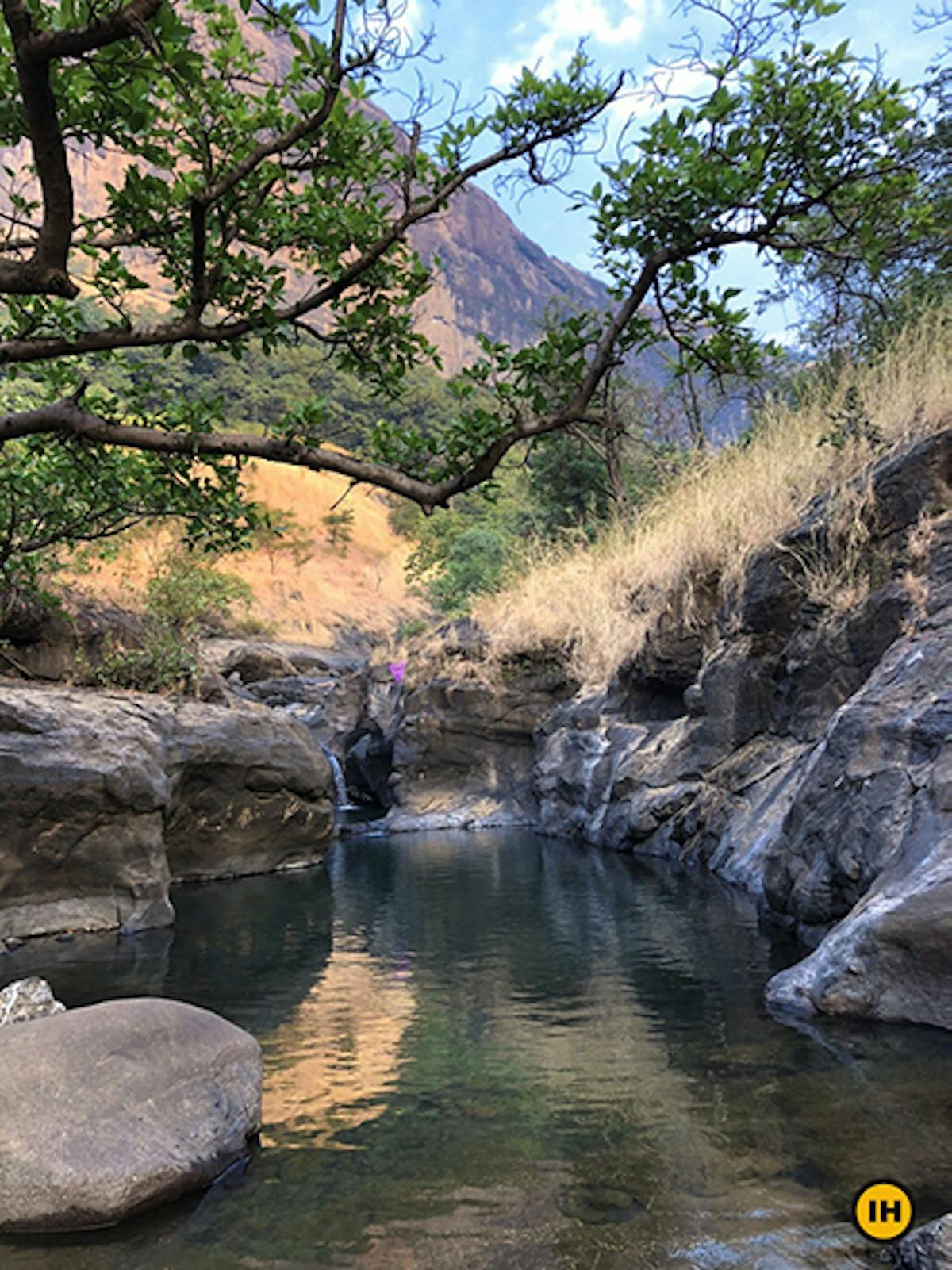
A pond while crossing the second stream PC: Apoorva Karlekar
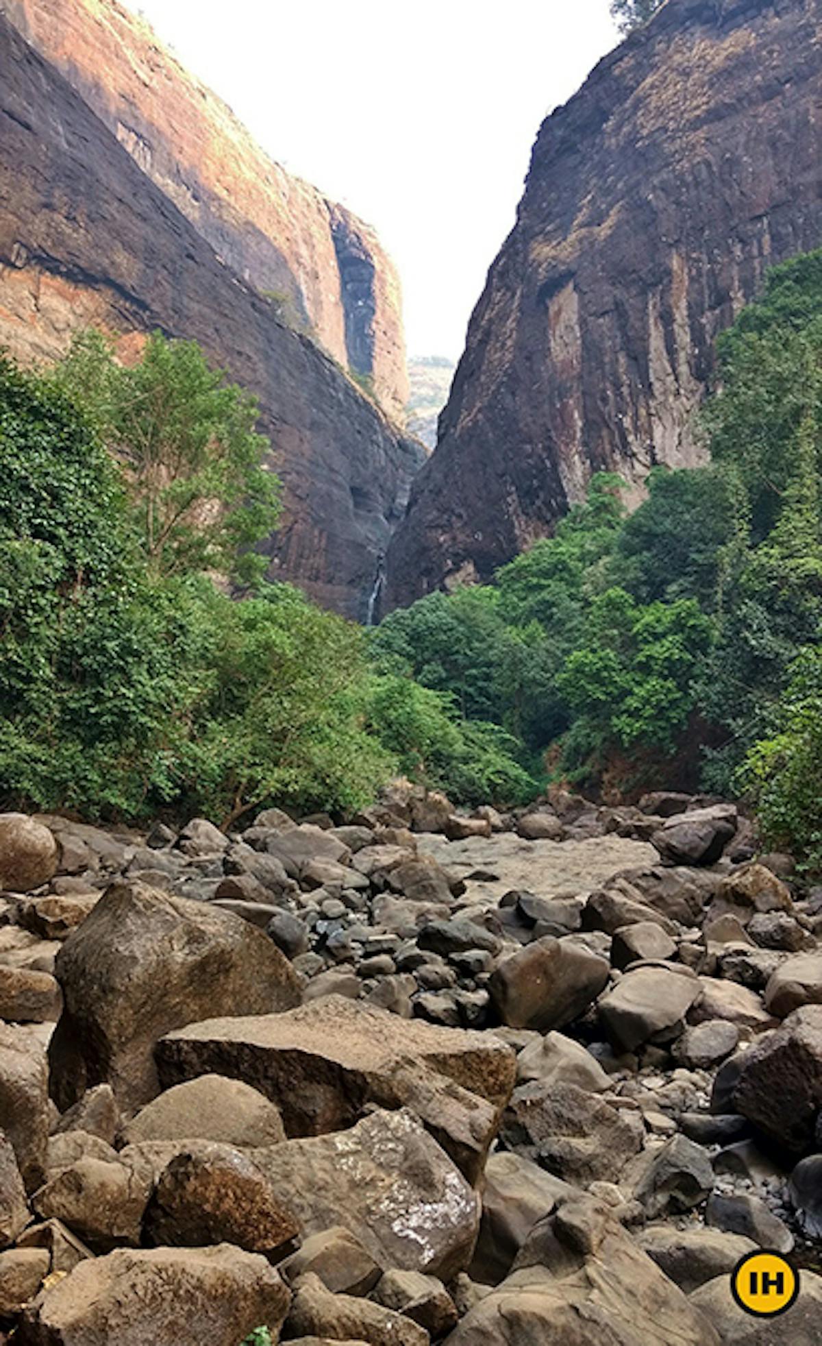
Rocky terrain just before the waterfall PC: Apoorva Karlekar
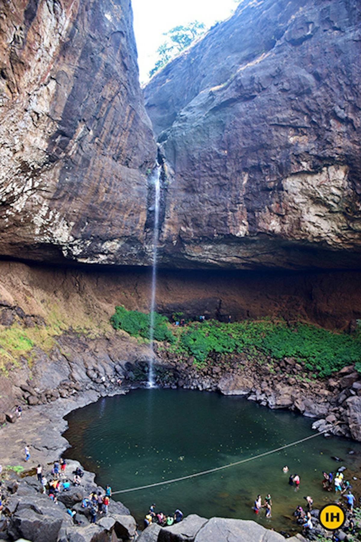
A rope marks out the safe section from the unsafe section in the pool formed by the waterfall PC: Apoorva Karlekar
➤ Trek Contribution
This trek has been researched and documented by Apoorva Karlekar.