Can You Help Us With Photographs Of This Trek?
We are looking to enrich this documentation with more photos. Pictures go a long way in explaining the trail, more than words ever can. If you have done this trek, can you share your photos with us? We will include them on this page, with due credit to you. Click here to contribute.
The Complete Guide to Satpura Forest Trail
The Satpura Forest Trail is a trek that takes you deep inside the jungles of Satpura Tiger Reserve, in the Hoshangabad district of Madhya Pradesh. Starting from Pachmarhi Hill Station, which is often referred to as the ‘Queen of Satpura Tiger Reserve’, the trek follows along the core conservation zones with a bit of James Forsyth trail sprinkled over.
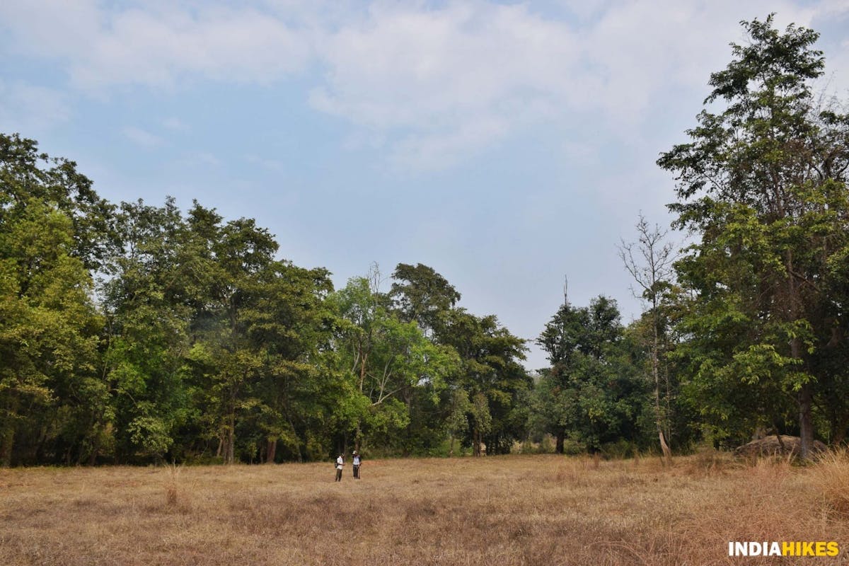
What takes you by surprise is each day you are walking in a different setting. If you’re walking along the Bainganga river one day, you will be surrounded by a thick mix of Axlewood, Teak, Mango, Sal, Arjuna, Mahula and many other varieties of trees on the next day.
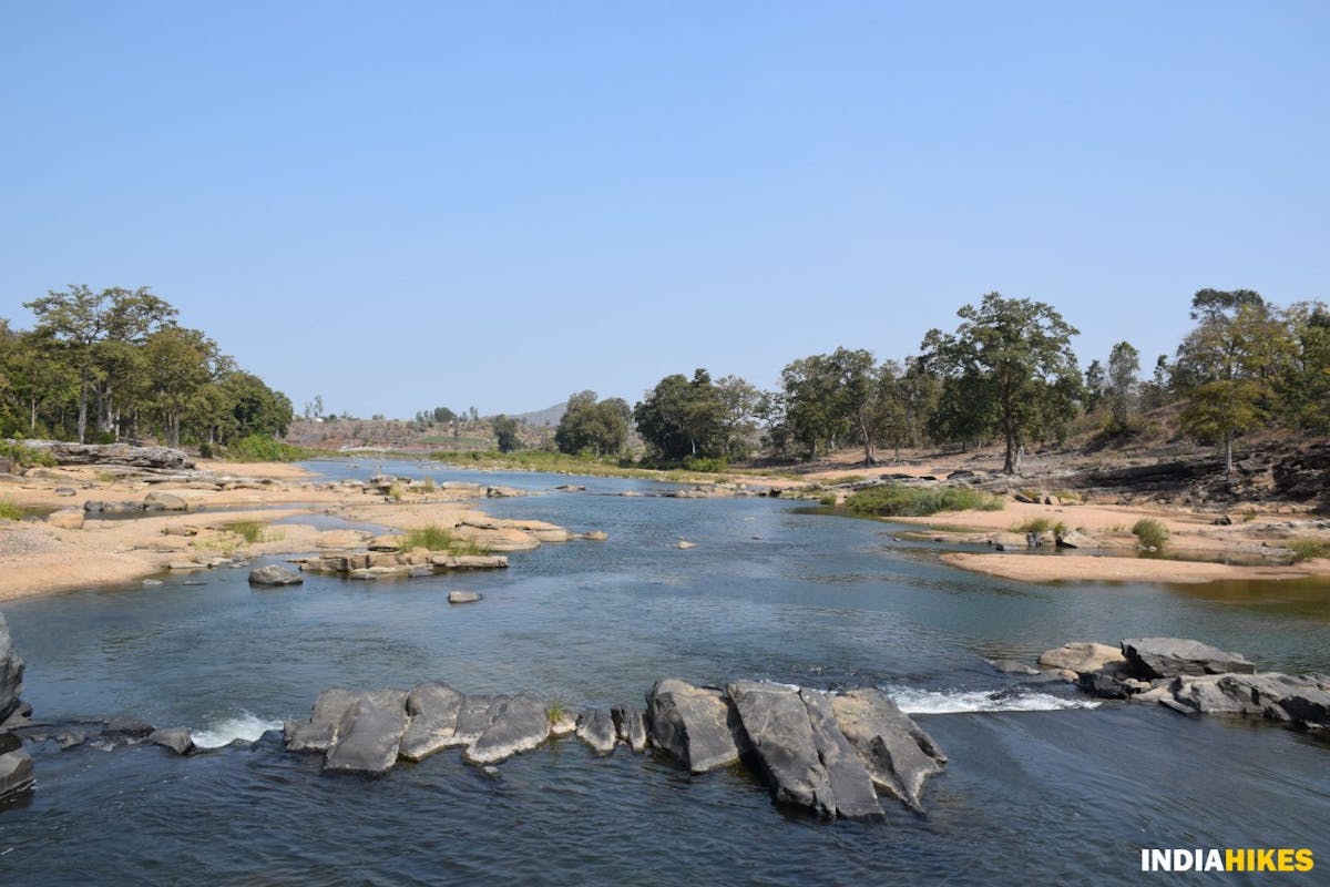
Varied landscape of the Satpura Tiger Reserve, captured in one frame. Picture by Nitesh Kumar
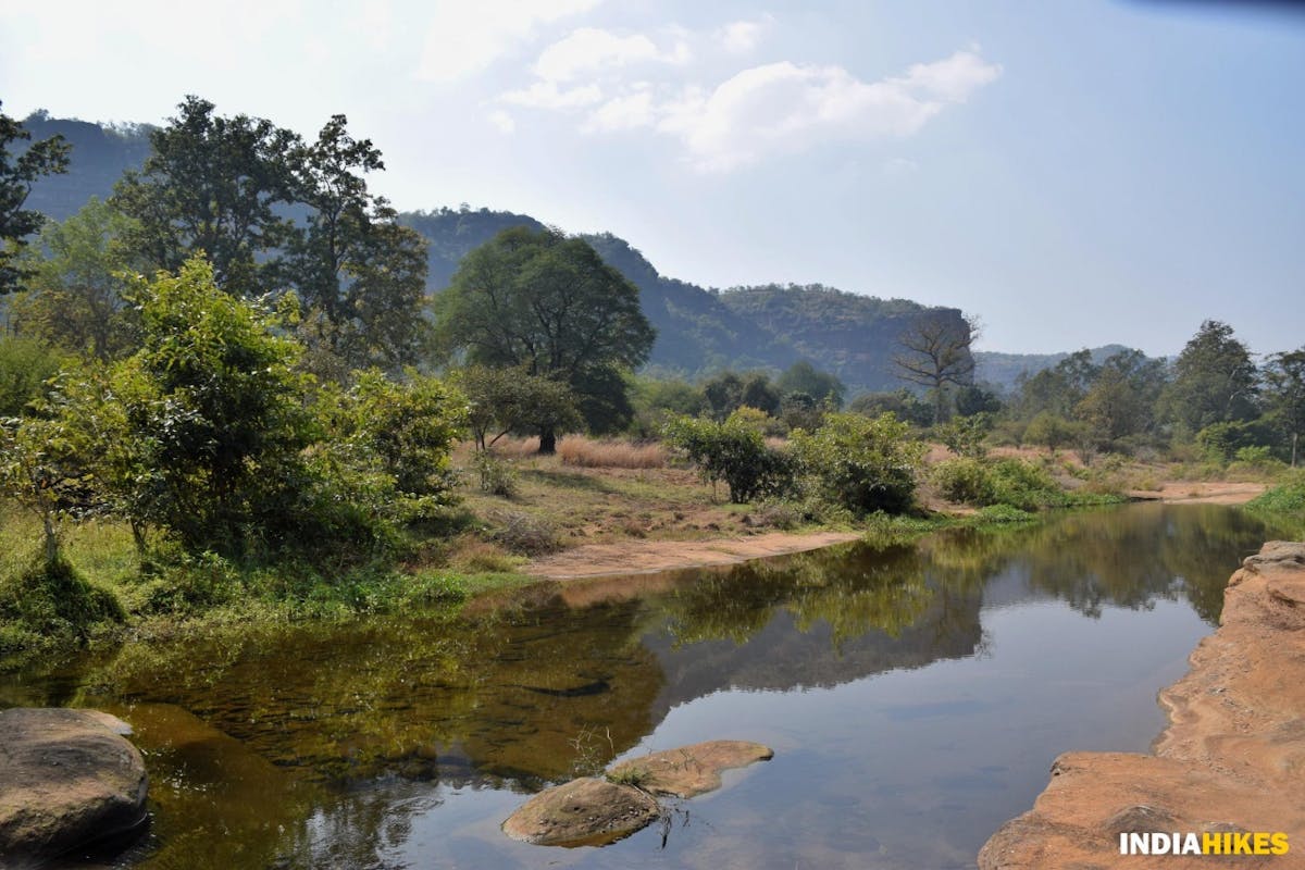
Today if you’re walking on a cliff, with a view of the entire valley where the Denwa river flows like a tiny stream, tomorrow you will be soaking the sun in the sandy beaches and the backwaters of Satdhara.
The Satpura Forest Trail needs a keen eye to observe a thousand different things happening all around you. If you are not curious about your surroundings, you might miss out on many things that hide in plain sight. Such is the beauty of this trek.
A blackbuck may just cross paths with you, and you wouldn’t even notice it if you’re not observant on the trek. Picture by Nitesh Kumar
What makes this trek even more special, just like our Chhattisgarh Jungle Trek, is that you need the Forest Department to help you get inside the Tiger Reserve.
These are reserved areas and access to the common man is prohibited. So with the help of the Madhya Pradesh Forest Department, we get to explore a real, wild jungle untouched by safari tourism. It is not often you get to experience the jungles of our country like this.
Denwa river cuts through rocks inside the national park. Picture by Nitesh Kumar
The trek is meant for those who want to experience trekking through the wilderness. If jungles and wildlife are fascinating for you, then this is the trek you must do.
A word of caution: While the trek is by no means difficult, it is not easy on the legs either. There are long walks every day – about 7 km on largely forested terrain filled with gorges, ravines, sandstones and river crossings. Fitness is critical.
➤ Table of Contents
Just like you, we love trekking! And this is a trek we’ve documented in great detail to help you do it on your own. Drop in comments at the end of the page if you need any help! You will get all the information required to do the Dafeybhir Pass trek on your own.
To navigate through the documentation easily, use this section of Table of Contents.
- Highlights of Satpura Forest Trail
- Quick Itinerary
- GPX File of Satpura Forest Trail
- Know Your Trek
- How Difficult is Satpura Forest Trail?
- Is Satpura Forest Trail Safe?
- Best Time to do the Trek
- How to Plan Your Travel
- What to Take on Your Trek
- How to Get Fit for Your Trek
- Frequently Asked Questions
- Nearby Places to Visit
➤ Highlights of Satpura Forest Trail
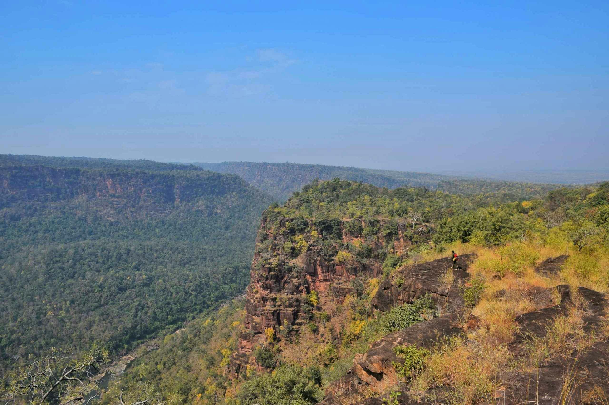
1. Walking on a cliff with a vantage point of the Tiger Reserve
Walking on the cliff gives you a vantage point of the Muar Valley and the Satpura Tiger Reserve. Picture by Nitesh Kumar
We have seen treks where you walk on a ridge, or in the valley. Satpura Forest Trail is the first trek where we walked on a cliff, with the view of the entire national park on one side, where the Denwa river looks like a small stream in the Muar Valley below.
The scenery stays with you for a good 2.5 kilometers, giving you an opportunity to scout the entire region from different angles. Come prepared with your binoculars to spot many surprises from this vantage point.
On your right is a plateau filled with trees of different kinds, leading into the thick forest. This is a unique setting that you’ll only experience on the Satpura Forest Trail trek.
2. Sandy beaches of the Denwa river
Camping in a setting such as this is a common sight on the Satpura Forest Trail. Picture by Nitesh Kumar
Trekking on the sandy shores of Denwa river is another highlight worth mentioning.
On the last day of your trek, you’ll trek on the riverbed with the thick forest on your right, and the calmly flowing river on your left. There are many spots on this day where you’ll just want to lie down on these beaches with your favourite book in hand and sunbathe the whole day.
You will also see many wild ducks, also called Mallards flying effortlessly from one end of the river to another. It is a setting that is picture-perfect!
3. A chance to follow the same path as the Tigers of Satpura
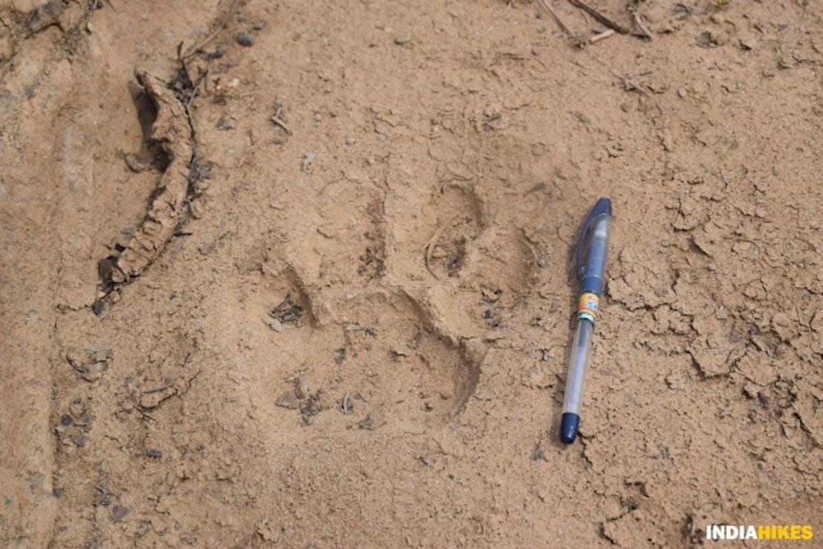
A tiger pugmark on the Satpura Forest Trail. Picture by Nitesh Kumar
True to its name, the Satpura Tiger Reserve is home to the largest tiger population of the region. Yet, it is rare to spot a tiger in these vast jungles.
But when you suddenly come across pugmarks of a tiger on the same trail that you’re walking on, you’ll get goosebumps knowing that a tiger has just passed and perhaps is keeping a close watch on you!
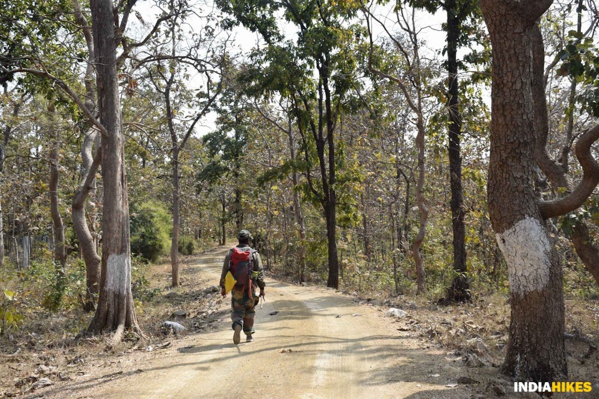
Such is the thrill when you trek in the forests of Central India. You are always followed by animals, but you will never find out. At the same time you will feel safe as you are accompanied by the forest guard of the National Park.
4. A paradise filled with flora and fauna
When we hear of Satpura Tiger Reserve, we would never associate it with birdwatching. The truth is, the Satpura Forest Trail is a feast for birdwatchers.
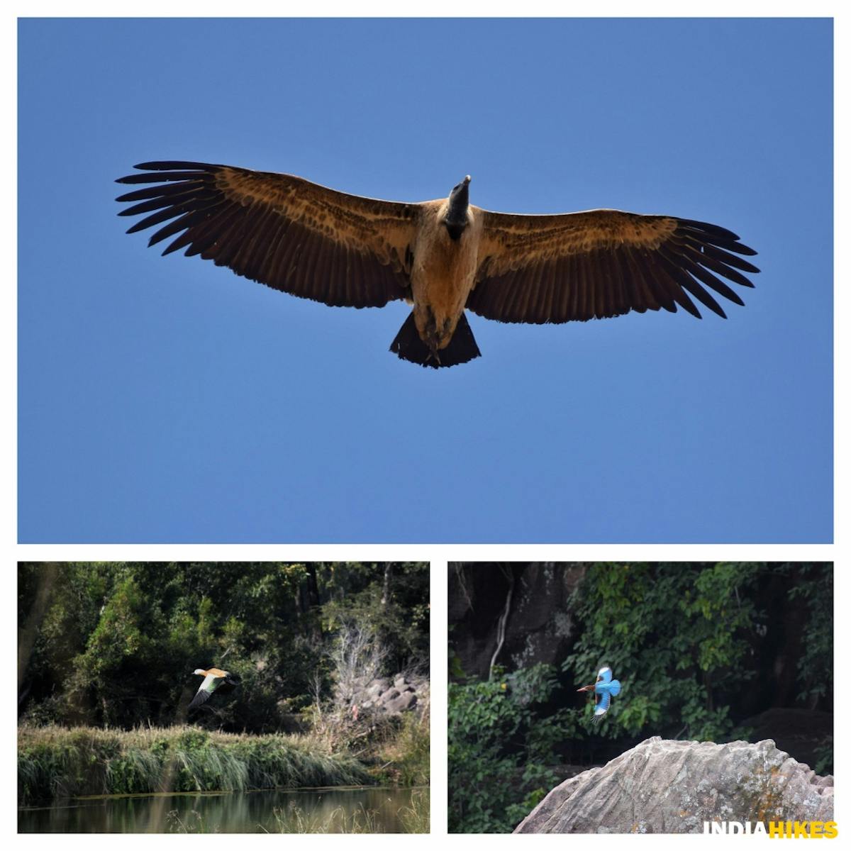
Indian Vulture, Mallard and a Kingfisher taking flight in the Satpura Tiger Reserve. Picture by Nitesh Kumar
Spotting different species of birds like Kingfishers, Bushchats, Vultures, Rollers, Treepies, Hawks, Orioles, Mallards etc., are a common sight every day.
If you are someone who is fascinated by the beauty of these wonderful creatures, then the Satpura Forest Trail is the perfect trek for you.
A mix of axlewood, teak, sal, mahula, arjuna, mango and many other trees are found inside the Satpura Tiger Reserve. Picture by Nitesh Kumar
Flora is another reason to trek inside the Satpura Tiger Reserve. There are many different species of trees like Axlewood, Teak, Sal, Mahula, Arjuna, Mango, Camel Leaf etc., are found in this region.
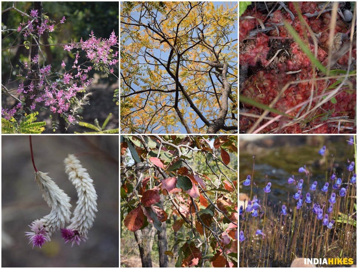
A variety of flowers are also found on the Satpura Forest Trail. Picture by Nitesh Kumar
Satpura Forest Trail is a potpourri of all the great things found in nature, which is a dream come true for the nature lover in all of us.
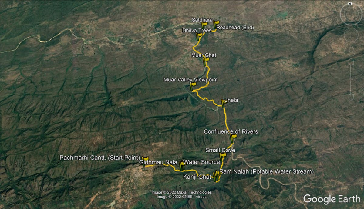
Route Map of the Satpura Forest Trail. Screenshot on Google Earth Pro
Day 1: Drive from Bhopal to Pachmarhi Cantonment. Trek from Pachmarhi Cantt. to Kanji Ghat
Drive Distance: 195 km | Duration: 5-6 hours
Trek Distance: 7 km | Duration: 4 hours
Reach Pachmarhi Cantt. by taking the shared taxi arranged by Indiahikes from Bhopal. The drive is approximately 5.5 hours and takes you through the interiors of Madhya Pradesh, crossing the Tawa river.
Trek Type: From Pachmarhi Cantt., it is a gentle descent through beautiful forests and waterfalls, all the way to Kanji Ghat. Gidhmau Nalah, which you come across halfway through the trek, is your water source for the day.
Day 2: Trek from Kanji Ghat to Jhela
Trek Distance: 7 km | Duration: 4 hours
Trek Type: Easy. An almost flat walk along the Bainganga and Denwa rivers till you reach Jhela. Ram Nalah that splits from Bainganga near Kanji Ghat holds potable water. So refill your water bottles here before you start the trek.
Day 3: Trek from Jhela to Muar Ghat
Trek Distance: 8 km | Duration: 7 hours
Trek Type: Moderate. Today is a challenging day, as you gain almost 850 feet less than a kilometer. Trek along the cliff before descending down to Muar Ghat. Denwa river at either Jhela or Muar Ghat is your water source. Refill the water before starting on the trek as it is a long day.
Day 4: Trek from Muar Ghat to Satdhara. Drive from Satdhara to Bhopal
Trek Distance: 6 km | Duration: 3 hours
Drive Distance: 200 km | Duration: 5-6 hours
Trek Type: Easy. Walk on the flat, sandy beaches of Denwa river till Satdhara. Refill your water bottles at Muar Ghat as the water in the latter part of the trek is not fit for drinking.
Click here to go back to the Table of Contents.
➤ Know Your Trek
We have always wanted trekkers to be well-informed before they go on a trek. Knowledge is the difference between a safe trek and a dangerous one. It’s also the difference between a wholesome experience and a surficial experience.
Use this section to learn about the Satpura Forest Trail trek. It has in-depth information about each day of the trek, what to expect, and how you need to prepare for it. Many years of expertise have gone into this content. Don’t miss the ‘Frequently Asked Questions’ section. Trekkers find that extremely useful.
How Does Each Day Look
Day 1: Reach Pachmarhi Cantonment from Bhopal. Trek to Kanji Ghat
Trek Gradient: From Pachmarhi Cantt., it is a gentle descent through beautiful forests and waterfalls, all the way to Kanji Ghat.
Water Source: The waterfall you come across halfway through the trek is your water source for the day.
Take the shared vehicle arranged by Indiahikes to reach Pachmarhi Cantonment from where your trek begins. The drive is scenic and cuts through the interiors of Madhya Pradesh, across the Tawa river.
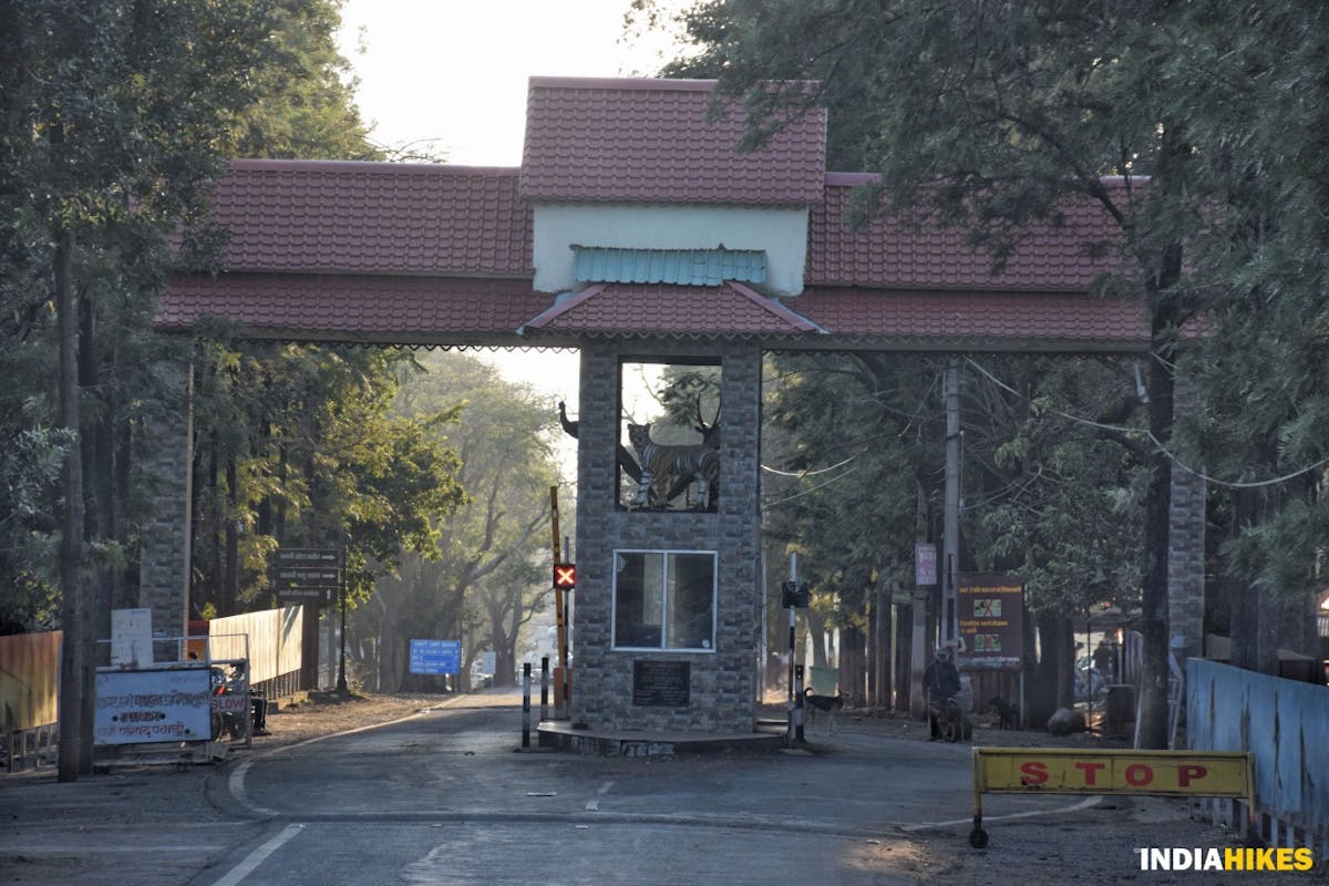
Pachmarhi Cantonment entry gate. Picture by Nitesh Kumar
Upon reaching the start point of the trek, take the trail on your right that leads you into the jungles of Satpura Tiger Reserve. Even though you do not feel it, you will descend for almost 1,800 ft today.
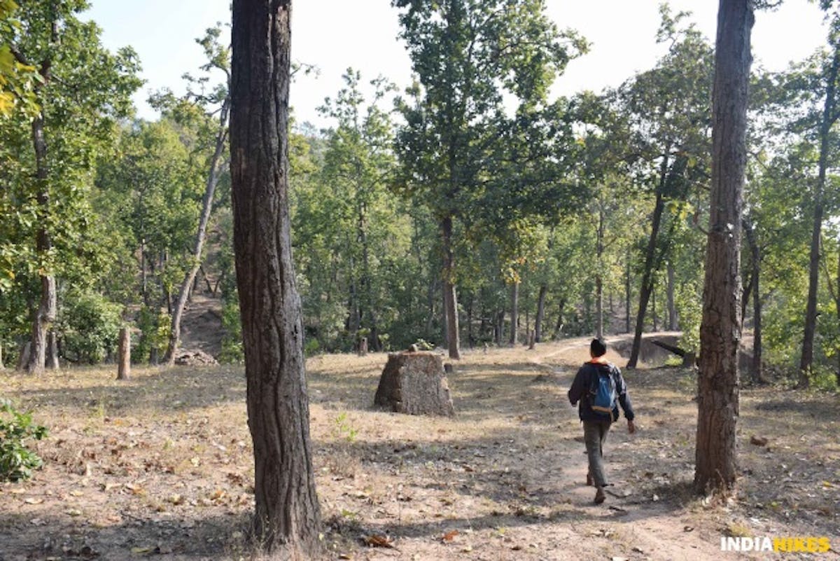
You will come across an abandoned fire check post on your right in less than a kilometer. Keep this as your waymarker to ensure you are on the right track.
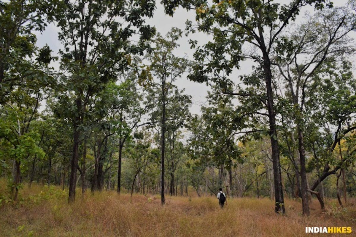
The sparse jungles start becoming thicker as you trek deep inside. Picture by Nitesh Kumar
As you trek deep into the jungles of Satpura Tiger Reserve, you’ll notice that the density of trees becomes thicker.
A uniquely shaped concrete milestone marks the beginning of the core conservation zone. Picture by Nitesh Kumar
Keep your eyes open as you are entering the core zone of the forest. If you are lucky, you will spot blackbucks, spotted deer and other creatures all around you.
As you enter the core zone, you will notice a heap of rock and mud. This is a man-made structure by the tribal people who live in and around Satpura Tiger Reserve.
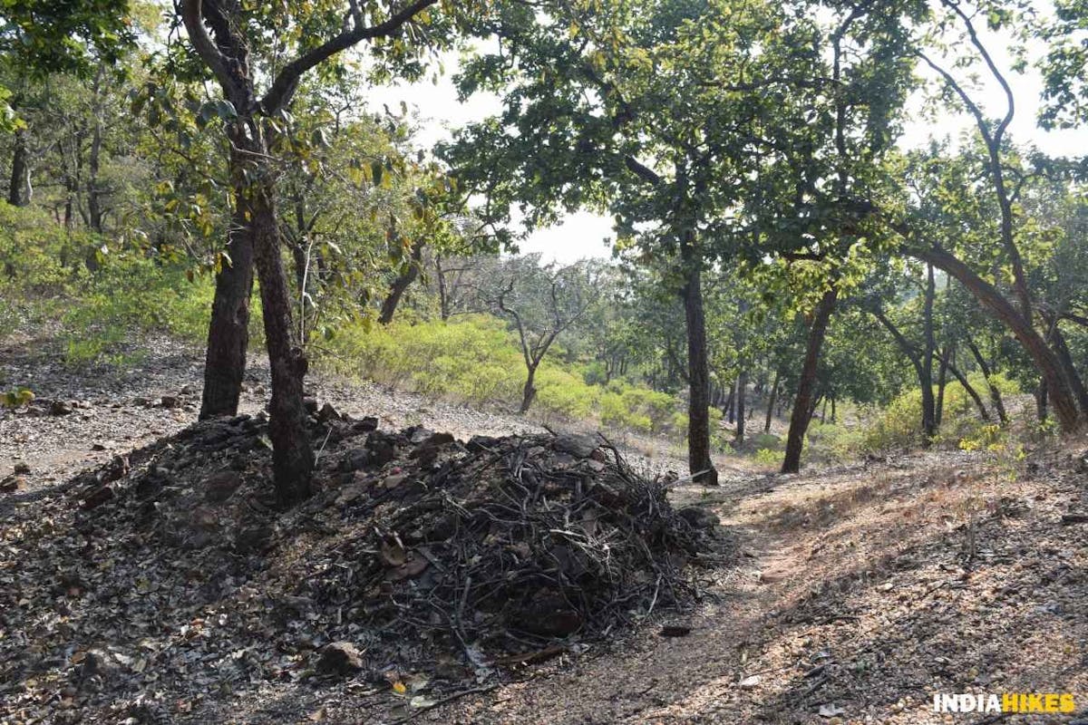
A structure believed to be the local deity is prayed to by the tribal people of the region. Picture by Nitesh Kumar
This heap of rocks is believed to beBanjari Devi, the local deity of the tribal people. They pray to this structure by formingcairnsin odd numbers before crossing over to the other end of the forest. They believe that this ritual keeps them safe on their journey.
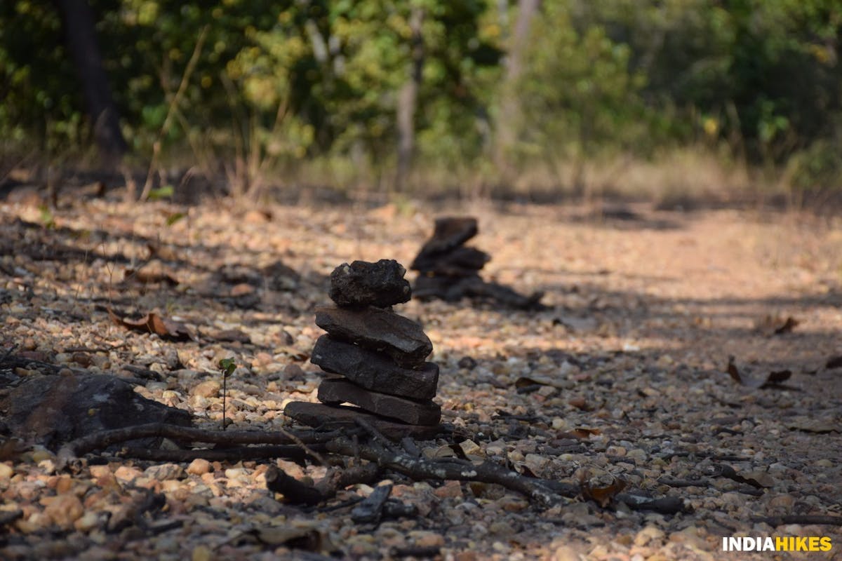
Cairns formed in odd numbers are an offering to Banjari Devi, the local deity. Picture by Nitesh Kumar
About an hour and a half into the forest, you will come across your first water source, theGidhmau Nalah, or the Vulture Stream. It is named so because the vultures in the area have made the stream their water source.
Gidhmau Nalah is your first water source for the day. Picture by Nitesh Kumar
You will find many vultures flying around the stream, searching for food.
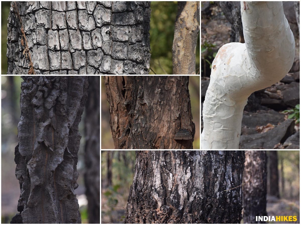
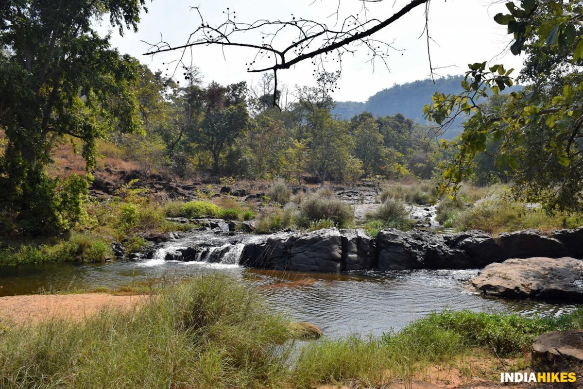
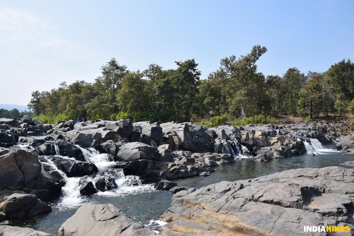
At the stream, notice the first of the sandstones which you come across on the trek. This pattern is unique to the region. It leaves you in wonderment thinking of the evolution that has taken place millions of years ago.
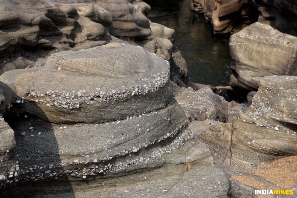
Constant water flow through these sandstones gives them a unique shape mixed with pebbles and rocks. Picture by Nitesh Kumar
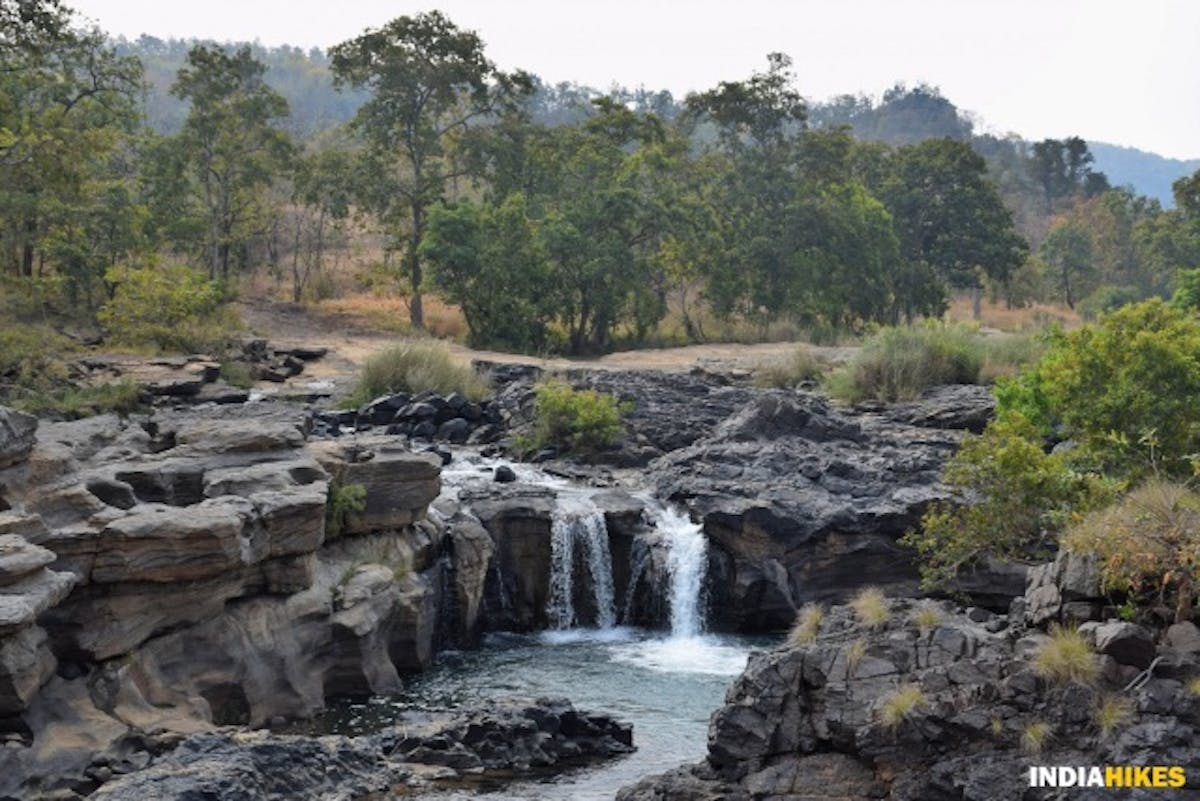
You will soon come across a small waterfall. If you’ve missed filling water at Gidhmau Nalah, fill up your bottles here as there is a long descent afterwards.
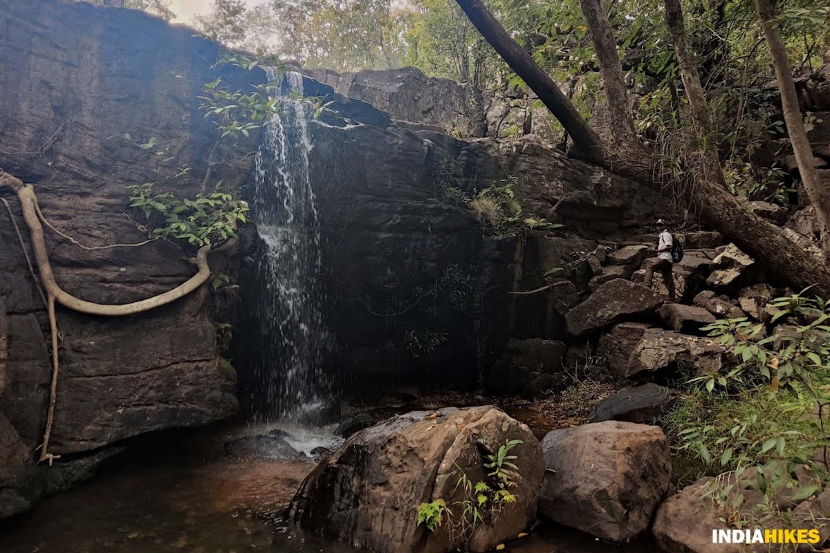
Waterfall on the way to Kanji Ghat. Picture by Nitesh Kumar
From the waterfall, the descent gets steeper. Ensure you are firm footed so that you don’t accidentally slip and fall en route.
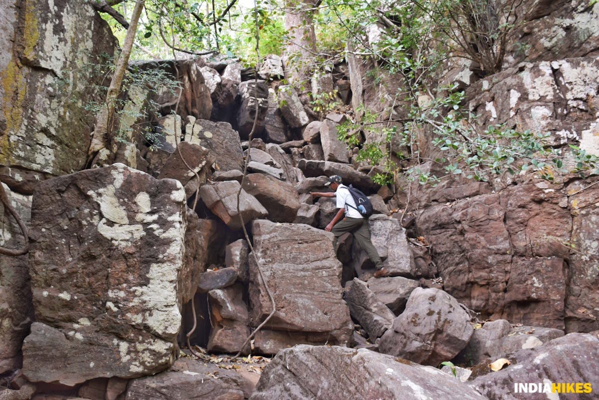
There are tricky sections during the descent. Exercise caution here. Picture by Nitesh Kumar
Sometimes you will descend on a dry river bed which exposes you to big boulders. Proceed cautiously in these sections.
In less than 2 kilometers since the descent, you will reach your first campsite for the day, Kanji Ghat.
Kanji Ghat campsite, right next to the Bainganga river. Picture by Nitesh Kumar
Kanji Ghat is a beautiful campsite in a wide clearing amidst the Sal, Arjuna and many different species of trees. The Bainganga river flows next to it.
Kanji Ghat campsite, right next to the Bainganga river. Picture by Nitesh Kumar
Kanji Ghat used to be the village of the tribespeople that lived in the core zones of Satpura Tiger Reserve. They were recently relocated to the habitable parts of the city once Kanji Ghat became one of the core zones of the National Park. You will find traces of their settlement here.
Enjoy the scenic campsite while you retire for the day. Picture by Nitesh Kumar
Walk around the campsite and find your spot to relax and wind up the day, while the Bainganga river flows gently beside you.
Day 2: Trek from Kanji Ghat to Jhela
Trek Gradient: Easy. An almost flat walk along the Bainganga and Denwa rivers till you reach Jhela.
Water Source: Ram Nalah that splits from Bainganga near Kanji Ghat holds potable water. So refill your water bottles here before you start on the trek.
Start the day by walking straight towards Ram Nalah and refill your water bottles. It is a flat for all the way to your next campsite.
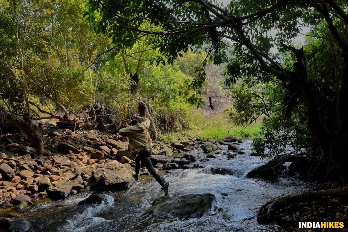
Few streams make you hop, skip and jump your way across. Picture by Nitesh Kumar
From here, you’ll need to hop your way to the other side of Ram Nalah. This gets slightly tricky if you try to crossover without taking your shoes off.
If you’re not confident of jumping your way across, find a safe spot where you can wear your sandals and cross over in the water. Most of the time the water is a little more than ankle-deep.
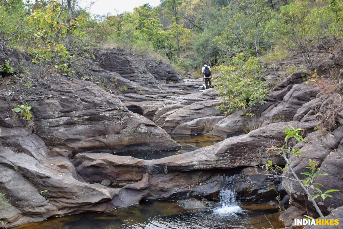
Gorge through which the Bainganga river flows. Picture by Nitesh Kumar
A beautiful gorge opens up in front of you as you cross the stream. Carefully make your way through it and move to the left of the river.
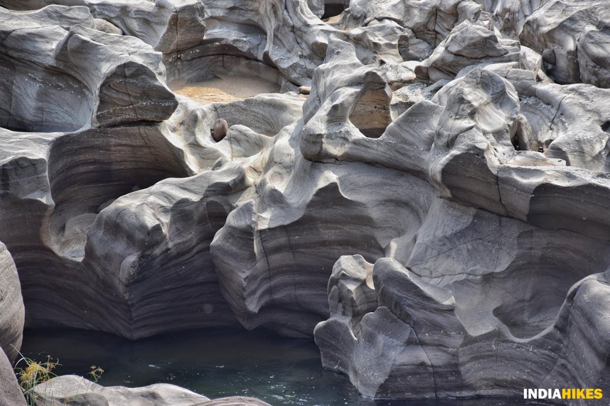
The unique sandstone patterns take you by surprise. Picture by Nitesh Kumar
While you make your way through the gorge, notice the unique sandstone formation. During the monsoon season, the gorge is buried under the river as the flow increases heavily.
It is only during the dry season that you get to witness the wonders of nature on the Satpura Forest Trail.
A sandstone resembling a battleship en route to Jhela. Picture by Nitesh Kumar
The sandstones bear many different shapes and sizes. We spotted a natural structure that resembles a battleship!
You begin to appreciate nature as you notice many wonders as you walk along the Bainganga river.
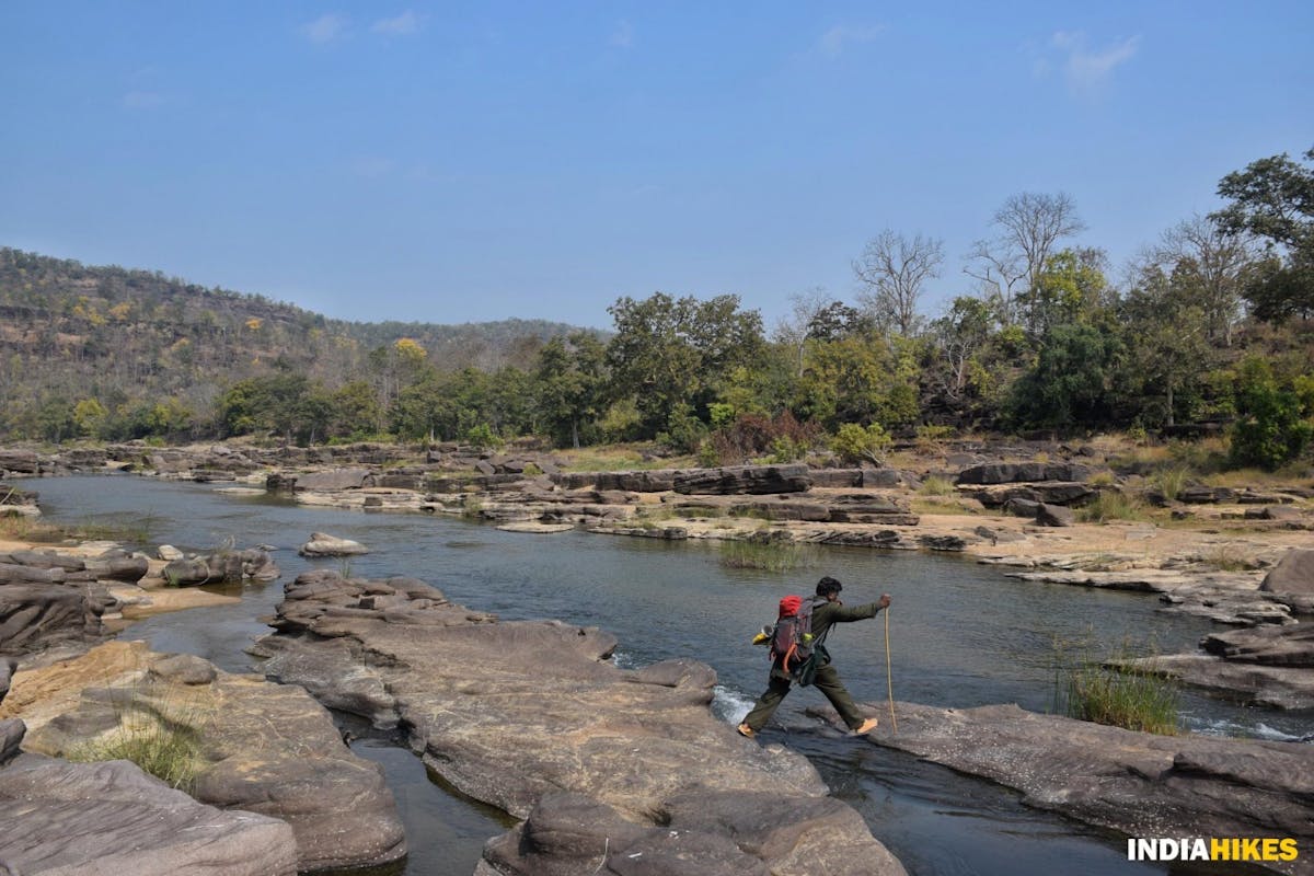
Hopping over boulders and crossing the river at multiple points becomes a norm on this day. Picture by Nitesh Kumar
After crossing over the river multiple times, you will come out of the valley to join the Denwa river which splits into Bainganga at this junction.
Denwa River Banks - Indiahikes - Nitesh Kumar
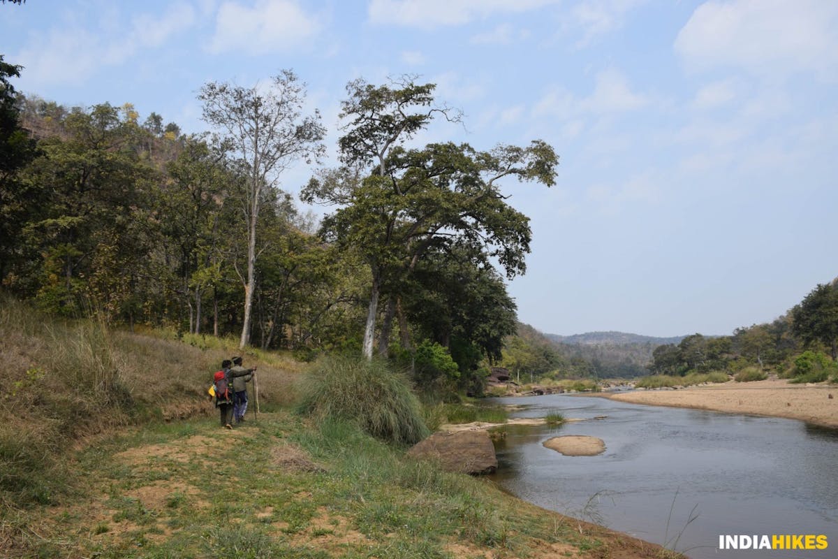
From this point onwards you will walk on the shores of Denwa river for a good 3 kilometers before reaching Jhela, where you will retire for the day.
Jhela campsite is on the banks of the Denwa river, under the tree. Picture by Nitesh Kumar
Jhela is located right on the banks of river Denwa, in a picturesque setting.
Since the space is less, pitch your tents a little to the right of the tree if the water level is too high.
Click here to go back to the Table of Contents.
Day 3: Trek from Jhela to Muar Ghat
Trek Gradient: Moderate. Today is a challenging day, as you gain almost 850 feet less than a kilometer. Trek along the cliff before descending down to Muar Ghat.
Water Source: Denwa river at either Jhela or Muar Ghat is your water source. Refill the water before starting on the trek as it is a long day.
Today is the most challenging and exciting day of the trek. After a lot of descents and flat walks from the past two days, you will ascend for almost 850 feet quickly through the forest.
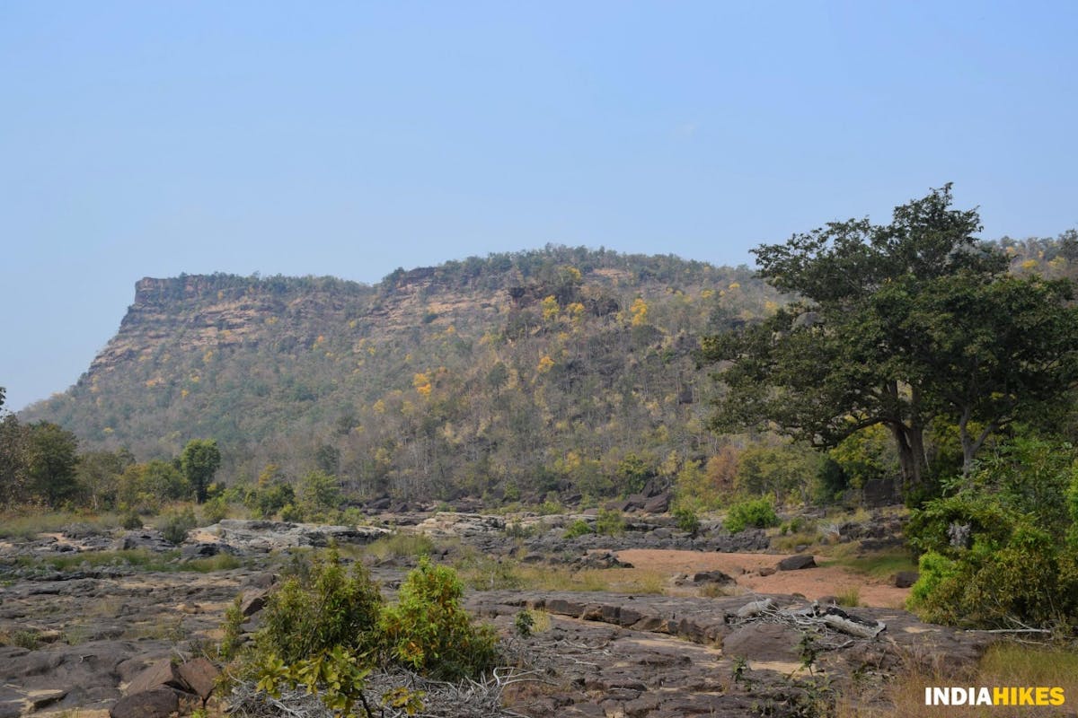
Walk towards the cliff you see on the right. Picture by Nitesh Kumar
From Jhela, walk straight towards the huge cliff that you see on your right. In about a kilometer you should start ascending through the thick jungle and hopping on the boulders.
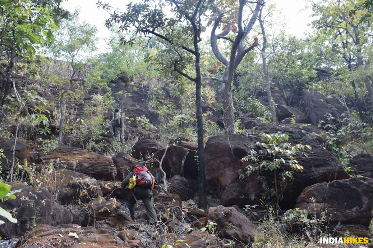
The tricky ascent through boulders. Picture by Nitesh Kumar
It gets slightly tricky here. Sometimes you might have to climb on all fours when the boulders are high. Take your time and go slow till you reach the top.
Tricky ascent 2-Indiahikes-Nitesh Kumar
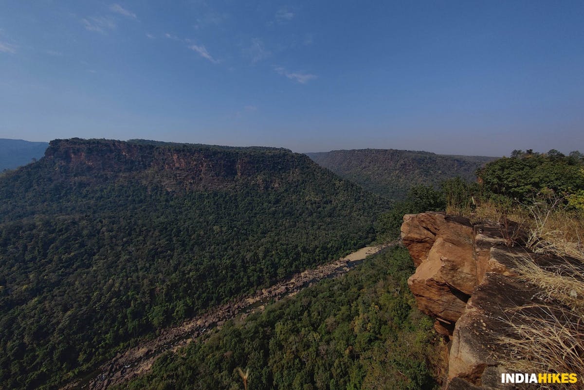
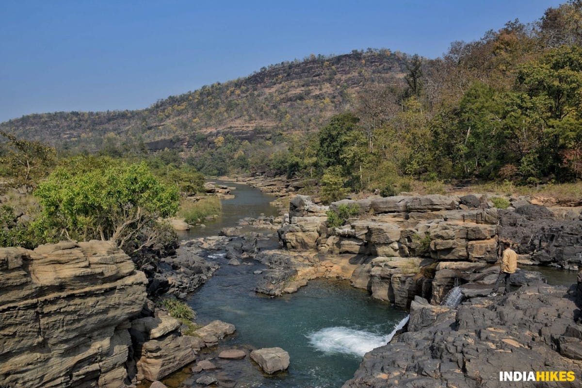
From the top, the view you get is something which you would not expect. Suddenly, the entire valley opens up to the left of you, and you’ll find yourself on top of everything else.
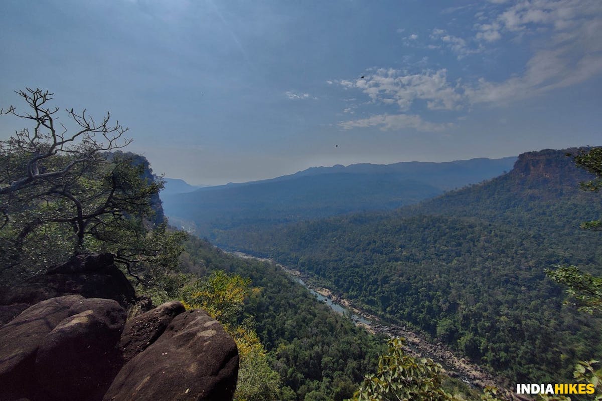
A vantage point that gives you a sweeping view of the entire valley. Picture by Nitesh Kumar
The Denwa river suddenly looks like a small stream and the lush green forests of Satpura Tiger Reserve come alive in a sweeping panorama.
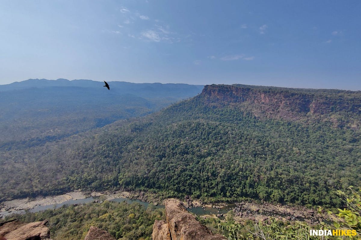
Birds fly at eye-level when you are on top of the cliff. Picture by Nitesh Kumar
Protip Carry a pair of binoculars to make the most of this view. You never know what you will find by scanning with your binoculars from left to right.
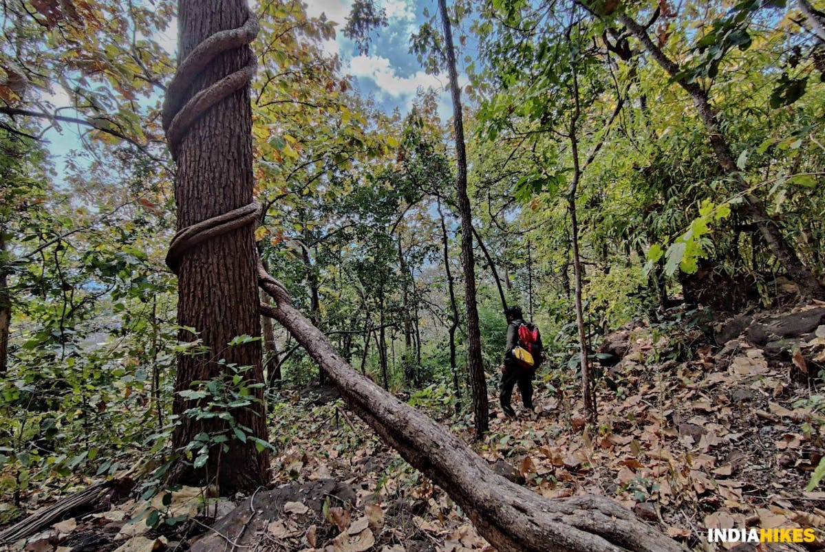
Huge roots wrap themselves around the trees in the forest. Picture by Nitesh Kumar
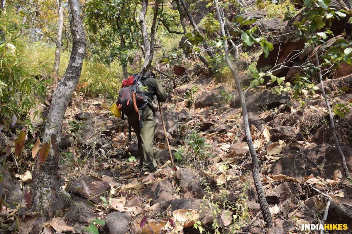
After a brief pause at the viewpoint, start your descent by heading back into the forest through the plateau.
The jungles begin to show their wonders yet again. You’ll see huge roots wrapping themselves around the tree trunk. There is not a single moment that seems monotonous on this trek.
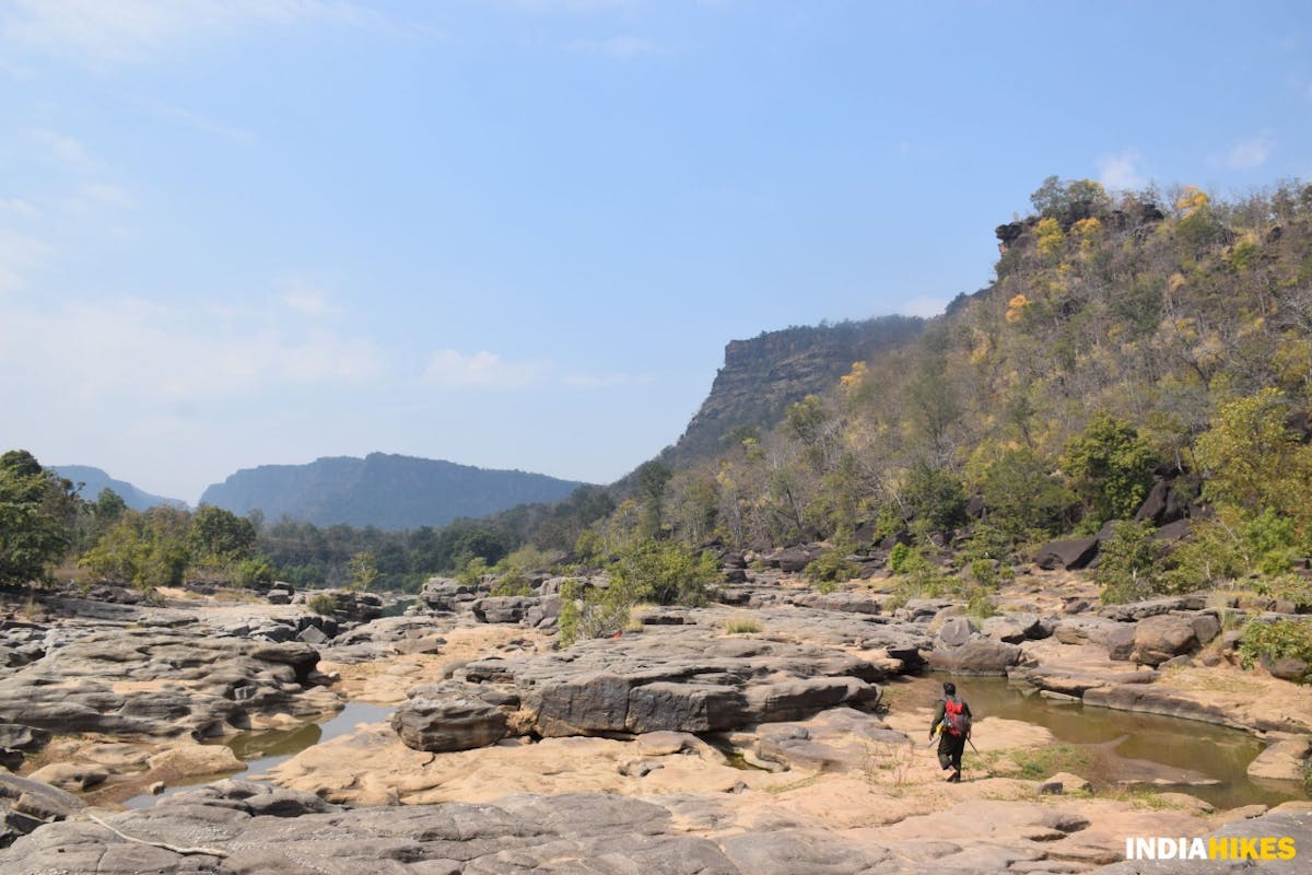
A steady descent for almost 2 kilometers brings you to Muar Ghat, where you will camp for the night.
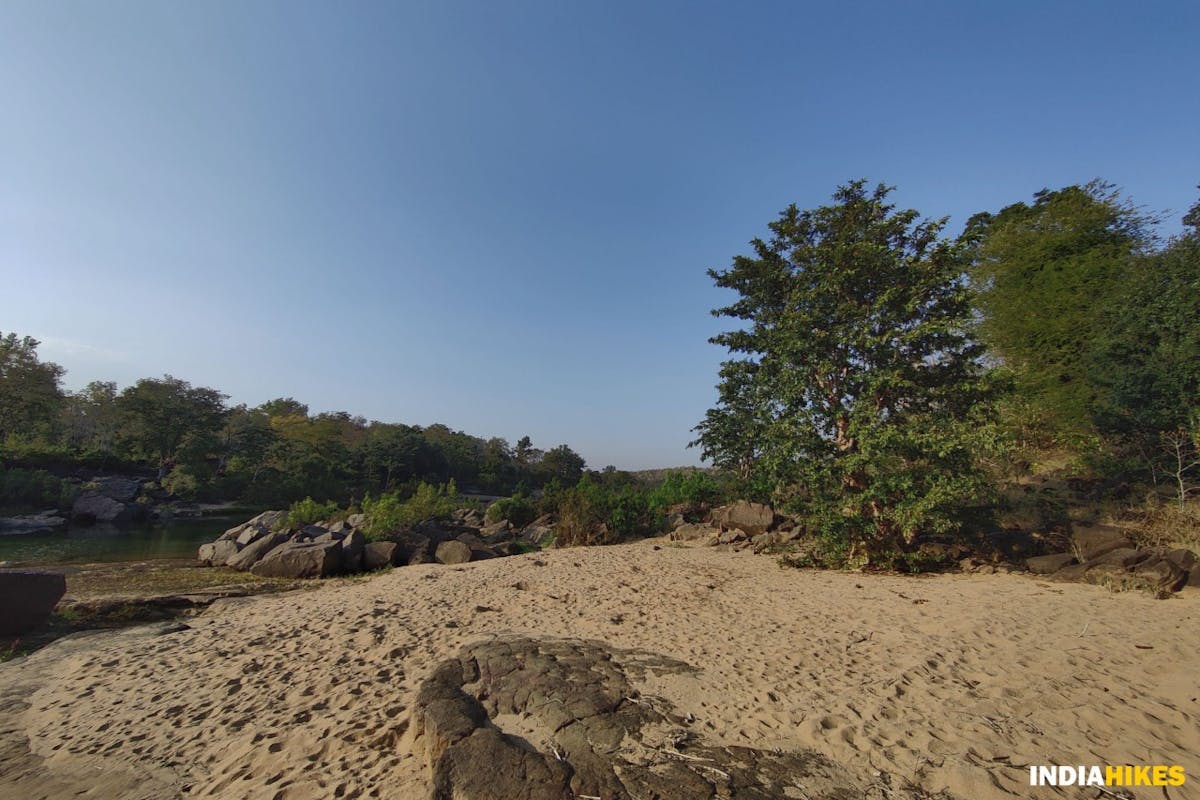
Muar Ghat is located on the sandy beaches of Denwa river. Picture by Nitesh Kumar
Muar Ghat is situated on the sandy beaches of Denwa river. After a long days’ trek, this is an ideal location to pitch your tents and watch the sunset along the horizon.
Day 4: Trek from Muar Ghat to Satdhara
Trek Gradient: Easy. Walk on the flat, sandy beaches of Denwa river till Satdhara.
Water Source: Refill your water bottles at Muar Ghat as the water in the latter part of the trek is not fit for drinking.
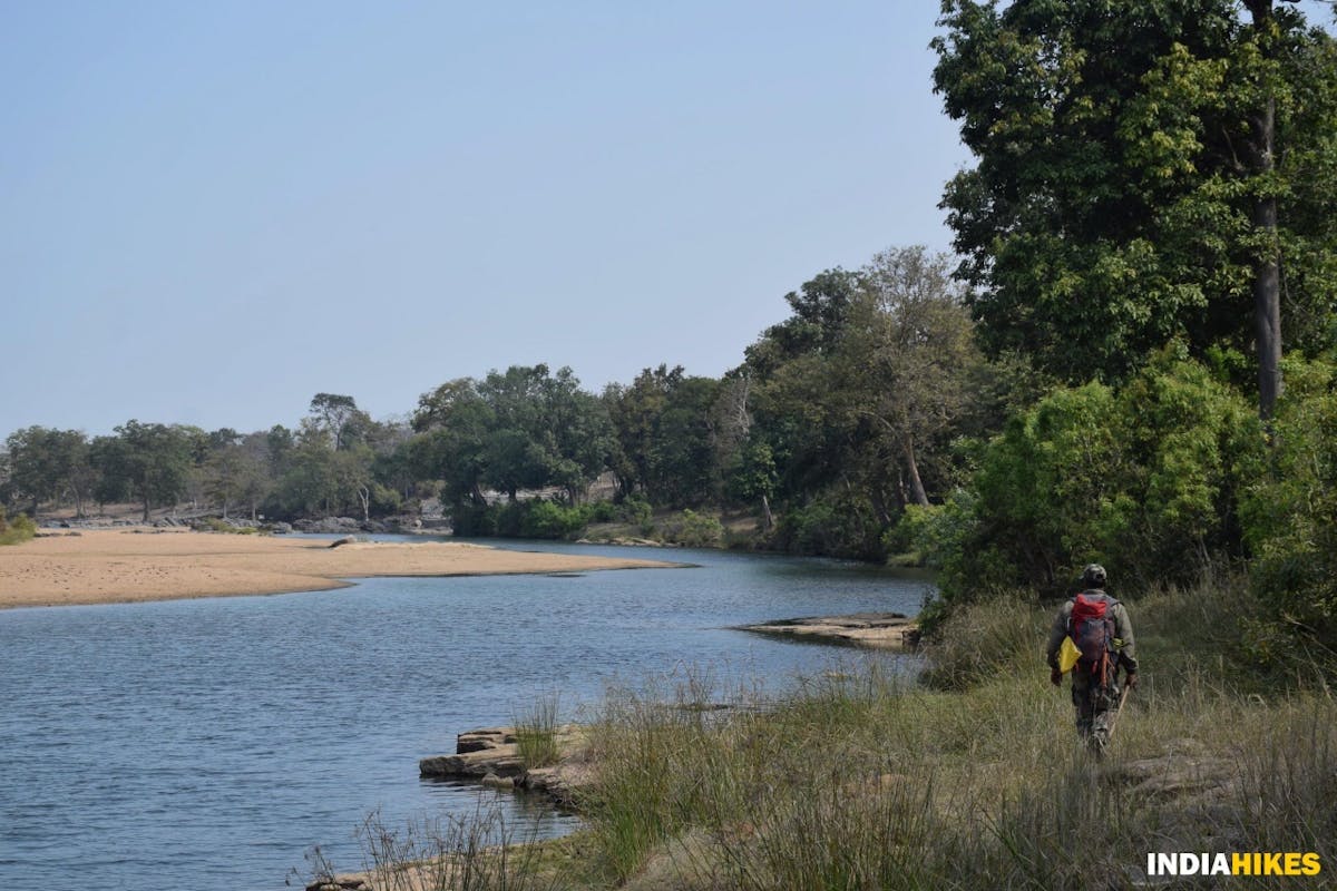
Today is all about walking on a flat land till you reach Satdhara. Even though the trail is 5 kilometers long, you will hardly feel the distance. This is because you will walk along the Denwa river which is much wider than before. This gives you a feeling of walking next to the backwaters of a reservoir.
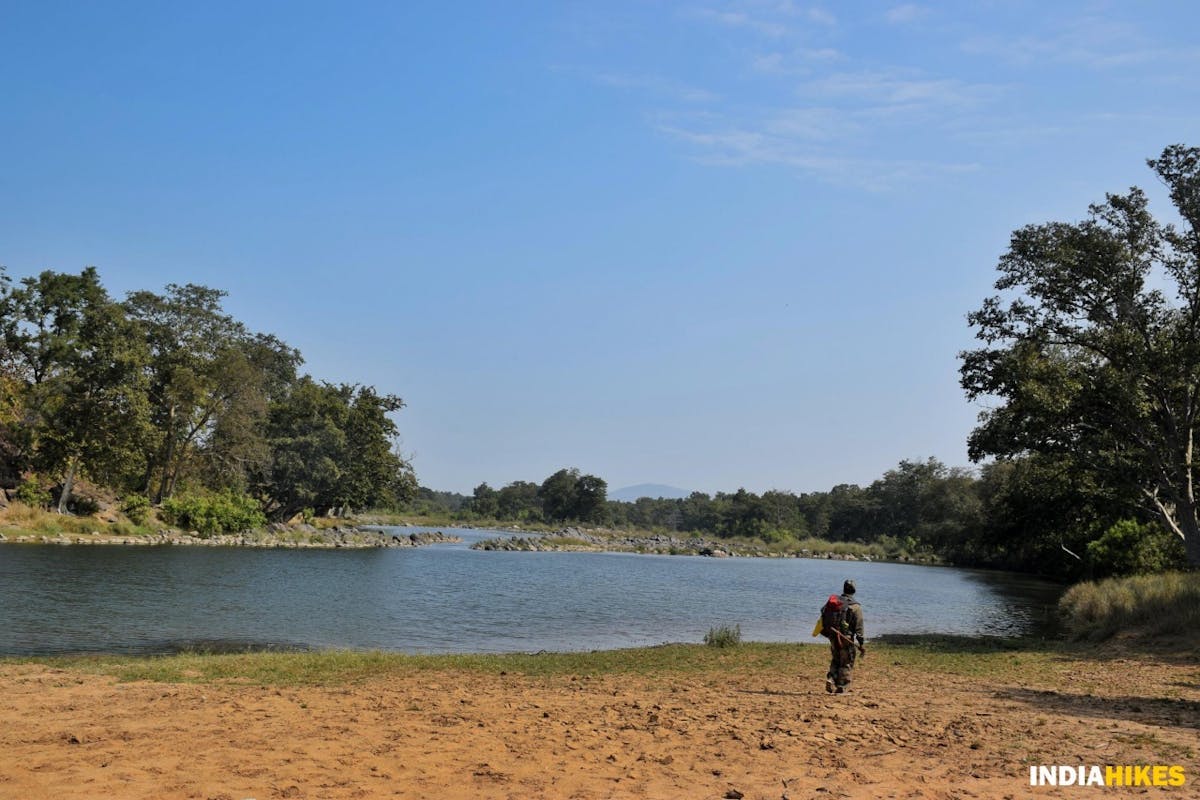
Walk next to a broader Denwa river on this day. Picture by Nitesh Kumar
If you love birdwatching, you should pay close attention to your surroundings on this day. There are Kingfishers, Mallards and other birds that casually fly from one end of the river to the other.
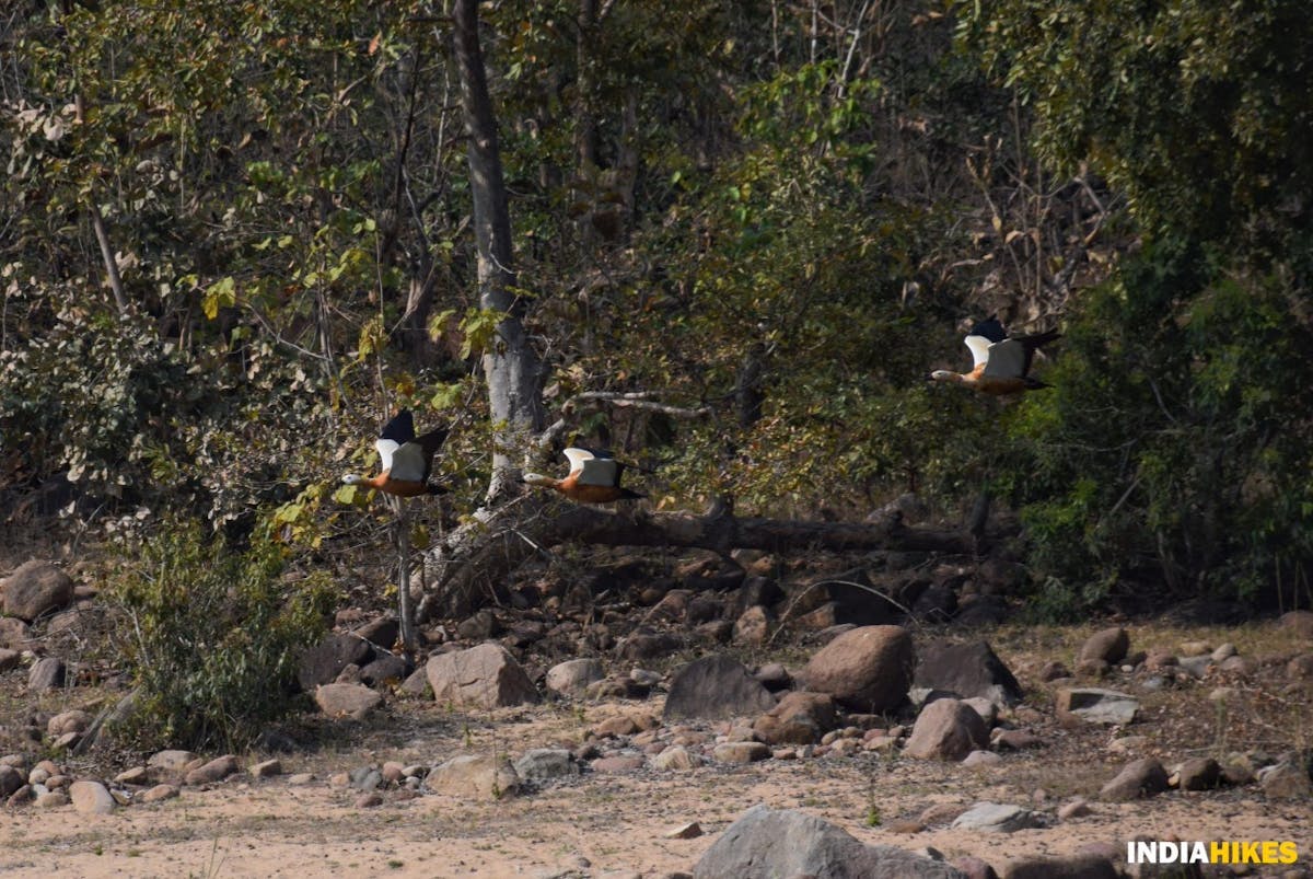
A flock of Mallards (wild ducks) flying across the river. Picture by Nitesh Kumar
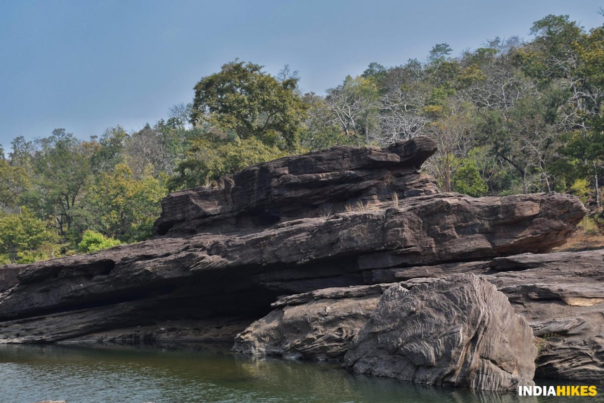
By the time you get over the excitement of spotting so many birds, you would have reached Satdhara, where the Denwa river flows through a slab of sandstone rocks that have formed a natural bridge across.
Denwa river splits and forms its tributary, Dudhe river at Satdhara.
View of the Denwa river from Satdhara. Picture by Nitesh Kumar
Satdhara is a popular tourist attraction in the Satpura Tiger Reserve. You are no longer in the core zone, and it is evident as you see people visiting the rocks from everywhere.
Sandstones that form a natural bridge across the Denwa river. Picture by Nitesh Kumar
Head straight to the roadhead where your vehicle will be ready for the pick up.
The last kilometer to reach the National Park entry gate. Picture by Nitesh Kumar
You will have to walk through the dirt trail for a kilometer before you reach the forest entry gate.
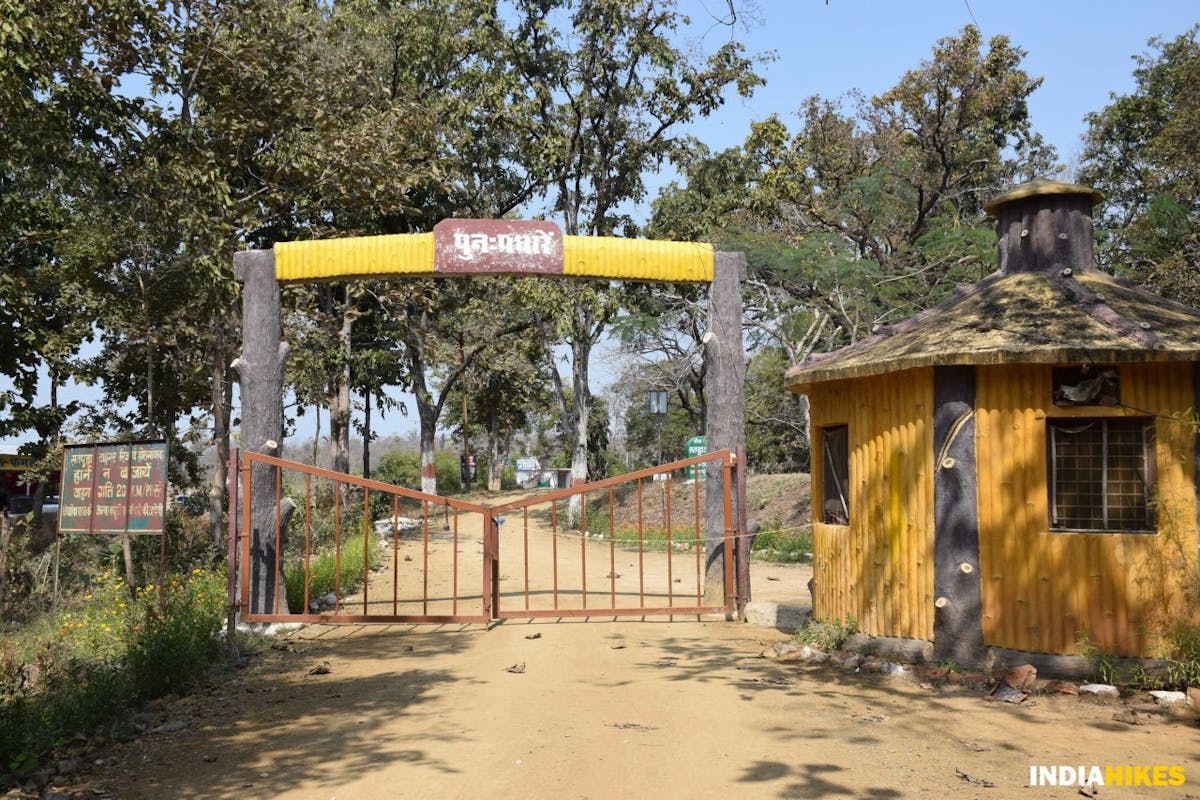
Your trek ends at the forest entry gate. Picture by Nitesh Kumar
The National Park entry gate marks the end of your Satpura Forest Trail. You will board the shared vehicles here and head to Bhopal, which is roughly 200 kilometers away.
If you are heading out of Bhopal, plan your travel after 8:00 PM on this day, after factoring in the long journey ahead.
➤ How Difficult is Satpura Forest Trail?
At Indiahikes, while rating a trek difficulty we consider a number of factors. These include altitude gained every day, length of trek everyday, highest altitude, nature of the terrain, weather etc. Based on this we rate a trek as easy or difficult or somewhere in between.
Here, we rate Satpura Forest Trail as an ‘easy-moderate’ trek. It is a trek that has long walking days on uneven terrain through the untouched jungles, and your safety depends a lot on the preparation you put in for the trek.
The trek is long and strenuous. It also climbs quickly on Day 3. Having prior experience of trekking helps in accustoming you to hardship.
➤ Is Satpura Forest Trail Safe?
Satpura Forest Trail is safe where the trail is concerned. The trail does not require special skill or any help is required for navigation as you will be accompanied by forest guards throughout.
Safety – Terrain Wise
Amongst our low altitude treks, Satpura Forest Trail trek poses low risk. There are no risky sections except a few at river crossings and when crossing through rocks and boulders.
Being mindful of where you place your foot, and being aware of your surroundings will help you a great deal in having a safe trek without any injury.
Safety – Weather Wise
Weather plays a big role in your safety on the trek. Here are some of the weather related issues that can play an important role on your Satpura Forest Trail trek.
Since you are trekking in Central India, the weather remains steady throughout the trek. The days get hotter, and the nights get colder. In the winter months, you will experience temperatures below 5 °C at all the campsites.
Rain showers can happen anytime due to the presence of thick jungles all around.
Being prepared with proper trekking gear will eliminate weather related risks on the Satpura Tiger Trail trek.
Exit points on the Satpura Forest Trail Trek
Medical Emergencies can strike on any trek. The key to dealing with them lies in knowing your exit points. Know how to get out and reach the nearest hospital quickly.
On the Satpura Forest Trail trek, your best bet is to reach any of the trailheads that are accessible to SUVs. Sita Dongri, Bari Aam and Rani Kheda are closer to the trail. If you’re trekking closer to any of these exit points, evacuation to a nearest hospital can be made very quickly.
Closest Hospital to Satpura Forest Trail Trek
In case of a medical emergency, the closest hospitals are at Pachmarhi and Pipariya. If you need serious medical attention, head to Bhopal for better facilities.
Click here to go back to the Table of Contents.
➤ Best Time to do the Trek
The best time to be on this trek is from early January to early March. In fact, that’s the only time you can trek here. In all the other seasons, the Satpura Forest Trail either gets too hot, or it is bashed with heavy rains.
During the monsoon season, the rivers that flow through the Satpura Tiger Reserve – Denwa, Bainganga and Dudhe – are ferocious till the water levels drop by the end of December.
Beginning of January to the first week of March is the ideal time to do this trek because the rains have cleared all the haze and the temperature becomes cooler. The jungles of Central India are best experienced in these cooler months. The overall atmosphere makes it for a very pleasant trek experience.
Day time temperatures will be between 15 °C and 25 °C, and night temperatures drop to 5 °C to 3 °C in winters.
➤ How to Plan Your Travel
If you’re trekking with Indiahikes, we will arrange for pick-up from Bhopal to the start point of the trek, Pachmarhi Cantt.
In case you do not opt for an Indiahikes pick-up, reaching Pachmarhi Cantt. on your own is not very difficult. There are three cities that are close to the start point of the Satpura Forest Trail trek.
Note: Reach Bhopal one day before the start of your trek (Day 0). Your pick-up will be early in the morning on Day 1. Reaching a day early will give you enough time to reach the pick-up point on Day 1.
Bhopal to Pachmarhi Cantt.
If you’re flying in, reaching Bhopal airport is the quickest way. From Bhopal, there are a number of trains that reach Pipariya. From Pipariya, many buses ply to Pachmarhi Cantt. on an hourly basis.
If you miss booking a train, the next best option is to take a cab from Bhopal to Pachmarhi Cantt. Do this only if you do not get a train ticket or if you are short on time, because hiring a cab is expensive.
Taking a public transport bus is the least expensive option, if you are someone who loves experiencing the culture and exploring places of the lesser known Madhya Pradesh. There are many buses that ply between Bhopal and Pachmarhi. Be sure of the bus timings before considering this as an option.
Itarsi to Pachmarhi Cantt.
The next option is to take a train directly to Itarsi by skipping Bhopal altogether.
From Itarsi, you may take a public transport bus to Pachmarhi Cantt., or hire a taxi if you are short on time.
Pipariya to Pachmarhi Cantt.
If you manage to get a direct train to Pipariya, it is the most preferred option to reach Pachmarhi Cantt. quickly.
It is easier to get public transport buses from Pipariya and the distance to the start point is shorter. This option is also the cheapest as it costs you Rs.80 for the bus ride from Pipariya to Pachmarhi Cantt.
➤ What to Take on Your Trek
Mandatory Documents
These are documents required for legal purposes by Indiahikes and the forest department. Without any of these, you will not be allowed to trek.
- Original and photocopy of government photo identity card. Anything such as a driver’s license, Aadhar card, passport will do. This is required by the forest department for your identification.
- Disclaimer certificate. This is a legal requirement. Download the PDF, read carefully and sign it. This must be handed over to your Trek Leader during registration at the base camp – Download PDF
- Medical certificate. There are two sections in this. The first part must be filled by a practising doctor. The second part must be filled by you. Without the medical certificate the forest department will not issue permissions for your trek. It is also a requirement by Indiahikes – Download PDF
Please carry the above documents with you. Documents need to be downloaded (PDF), filled in, signed, and handed over to the trek leader at the base camp.
Keep important documents in a clear plastic cover and slide them into the inner pocket at the back of your backpack. This keeps them from getting wet.
The Essentials
If you’re trekking in the Chhattisgarh jungles in winter, the temperature during the day will be at around 15 to 25 degrees and at night, the temperature will drop to 5 to 7 degrees. You will need to carry a minimum of two warm layers. Apart from this, ensure you carry your warm accessories such as synthetic (water resistant) gloves, woollen socks and balaclava.
Ensure you carry a pair of sandals, a poncho and full sleeve t-shirts and pants to have a comfortable trek.
Bare Necessities:
- Trekking Shoes: Carry trekking shoes and not sports shoes. The trail will be slippery at several places and will require shoes with good grip and ankle support. You can watch this video to learn to choose the right trekking shoes.
- Backpack (40-60 litres): A backpack with sturdy straps and a supporting frame. Rain cover for a backpack is essential.
Clothes
On a trek, carry fewer clothes than you would normally need. Do not pack for ‘what if situations’. That will only add to the weight of your backpack and not be used on the trek. Once your clothes get warmed up on a trek, you will not feel like changing. Just maintain personal hygiene.
- Two layers of warm clothes: If you’re trekking in winter, carry a fleece jacket and a padded jacket. (Note: In summers, the minimum temperature hovers around 22°c, so you wouldn’t need any warm layer.)
- Two trek pants: Carry light quick dry trek pants. One of your pants can be tights that you can wear as an inner layer while trekking. Denim/jeans and shorts are not suitable for trekking.
- Two collared t-shirts: Carry light, full sleeved t-shirts that prevent sun burns on the neck and arms. Let one of these be a dry-fit t-shirt. It will dry quickly in case you are trekking on a rainy day. A common mistake that trekkers make is not changing their t-shirts often enough. Regardless of how cold it is, the body tends to sweat a lot. Trekkers who don’t change to fresh clothes after reaching the campsite fall ill due to wet clothes and are often unable to complete their trek.
- Sandals: Carry sandals on this trek as there are multiple river crossings. Trekking shoes are required for the forest but have a handy pair of sandals to slip into.
Accessories
- Sunglasses: Sunglasses are mandatory. This is to protect you from the harsh winter sun.
- Sun Cap: In the jungles, even though there is heavy tree cover, the harsh sun can dehydrate you very quickly. A sun cap comes in handy to prevent the moisture from escaping when you are sweating.
- Hand gloves: A fleece or woolen gloves will do.
- Socks (2 pairs) and a pair of woollen socks: Apart from two sports socks, you can take a pair of woollen socks for the night.
- Headlamp/LED torch: Mandatory
- Trekking Poles: Watch this video to understand why you need a pair of trekking poles.
- Poncho: In a jungle, unexpected rain is possible at any time, and hence it’s mandatory to carry a poncho so that you don’t get wet.
Others
- Daypack (20 litres): You will need this to carry water bottles, light snacks and medical kit in case you decide to offload your backpack.
- Toiletries: Sunscreen, moisturizer, light towel, lip balm, toilet paper, toothbrush, toothpaste, hand sanitiser. Do not carry wet wipes since these are not biodegradable. We do not like biodegradable wet wipes because they take a long time to decompose in the mountains. Use toilet paper instead.
- Sanitary waste: Make sure you bring your used sanitary napkins back to the city with you. Carry a zip lock bag to put used napkins. Bring this ziplock bag back with you to the city and do not dispose of sanitary napkins in the mountains.
- Cutlery:Carry a spoon, coffee mug and a lunch box. We insist on trekkers getting their own cutlery for hygiene reasons. We do not allow biodegradable or disposable cutlery on our treks.
- Three water bottles: 1 litre each. We recommend the Paany bottle. Indiahikes trekkers can get it at a discount here.
- Plastic covers: While packing, use plastic bags to compartmentalize things and carry a few extra plastic bags for wet clothes.
- An insect repellant spray/cream.
Personal Medical Kit
Carry these medicines with you, easily accessible at all times. Do not take any medicine unless you have consulted your trek leader.
- Crocin – 6 tablets (fever)
- Avomine – 4 tablets (motion sickness)
- Avil 25 mg – 4 tablets (allergies)
- Combiflam – 4 tablets (Pain killer)
- Norflox TZ & Lomofen – 6 tablets each (diarrhea)
- Digene – 10 tablets (acidity)
- Omez/ Rantadine – 10 tablets (antacids)
- Crepe bandage – 3 to 5 meters
- Gauze – 1 small roll
- Band Aid – 10 strips
- Cotton – 1 small roll
- ORS – 10 packets
- Betadine or any antiseptic cream
- Moov Spray (aches, & sprains)
- Knee Cap, if you are prone to knee injury
- Antifungal Powder
- Odomos or any other insect repellent
Our trek leaders carry a medical kit with them. If there is an emergency our trek leaders know how to tackle it. Meanwhile, contact your trek leader before consuming any of these medicines listed here.
ProtipWe find that these medicines by trekkers are rarely used. But you cannot do away with them. At the end of the trek please donate unused medicines to your trek leader. Some of these medicines get distributed to villages on the trek and some are added to the Indiahikes medical kit.
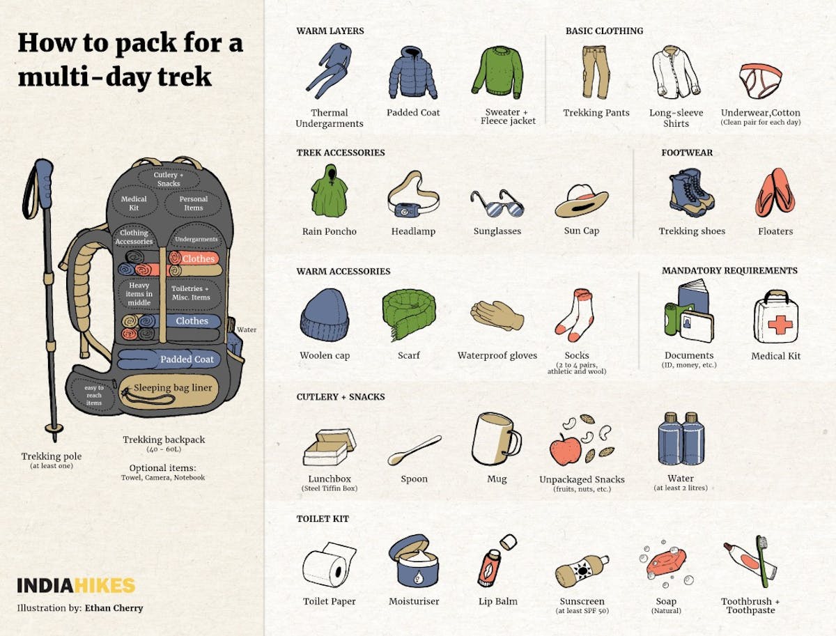
Here’s a quick infographic to give you an overview of everything you need in your backpack
Click here to go back to the Table of Contents.
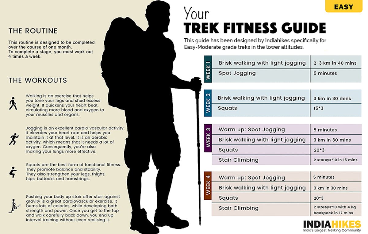
➤ How to Get Fit for Your Trek
How to prepare for Satpura Forest Trail
Satpura Forest Trail is an easy-moderate trek. You cover an average of 7 km each day. If you want to do this trek comfortably and enjoy all it’s glorious views, you will need to prepare well.
Cardiovascular endurance – Target 5 km in 45 minutes before the start of the trek
The Satpura Forest Trail trek requires you to have a good amount of endurance and stamina. You can begin by jogging everyday. Start slow and increase your pace everyday. Swimming, cycling and stair climbing without too many breaks in between can help too.
In order to be prepared for a high altitude trek, you should have a combination of distance and speed targets.
Here’s a fitness routine that works:
In case you’re just starting with a regular fitness routine, phase out your distance targets in the following manner –
–>Target completing 5 km in 45 minutes when you begin.
–> Gradually increase your pace by running 4 times a week and bring it down to 5 km in less than 40 mins.
–>This holds true for trekkers above 45 years also.
If you are somebody you prefers cycling over running, then try to cover 22 km in 60 minutes.
How to send us a proof of your fitness routine?
Record your run on an app like Nike Run. Start recording your run when you start running. At the end of your run, hit the stop button.
Take a screenshot of the summary of your run. We will need a detailed split of each kilometre of your run. This is usually integrated in all running apps.
Note: Make sure your GPS is on when you record your run. If the GPS is off, we will not accept the screenshot.
Upload two screenshots 10 days prior to the start of the trek — one of you covering 5 km in less than 40 mins along with your picture and the other with splits of your run.
Strength – Target 4 sets of squats with 20 in each set
This is another area you should work on. There is a lot of trekking distance that you will cover carrying your backpacks. You have to walk on uneven terrain during the trek. It could be taxing for your legs. For this, strengthening your legs will help. You can do some squats to strengthen them. Start with 3 sets of squats, with 8 squats in each set and work towards reaching your target in 3 weeks.
Flexibility
Another aspect that will help you trek comfortably is flexibility. For this, you can do some stretching exercises – stretch your hamstrings, quadriceps, hip flexors, lower back muscles and shoulders regularly. On your trek, it is important that you arrive on the slopes with your muscles relaxed. Carrying a backpack, however light, can become a strain after a while. These exercises will help you to be in good shape before the trek.
Here is a guide to help you get fit for the trek. (this includes Satpura Forest Trail)
Working out indoors
If you can’t go out and jog because of time and space constraints, here’s a video you can use to work out indoors.
➤ Frequently Asked Questions
1. Where is Satpura Forest Trail and how long is the trek?
The Satpura Forest Trail is inside the virgin jungles of Satpura Tiger Reserve, Madhya Pradesh. The trek is 28 kilometers long and is done over 4 days.
2. Can anyone do the trek on their own?
No. The Satpura Forest Trail trek is conducted in collaboration with the Forest and Tourism Departments of Madhya Pradesh. At present, you can only do the trek with Indiahikes and you will be accompanied by forest guards throughout.
3. How is the weather on Satpura Forest Trail trek?
The jungles of Central India tend to get very hot in the summer months. In monsoon, river crossing becomes difficult as the water level is too high.
This is why at Indiahikes, we conduct the trek only between January and early March because this is the most pleasant time to experience the jungles of Madhya Pradesh.
4. How to get to the trek?
To reach the base of Satpura Forest Trail trek, reach Bhopal and hire a vehicle (an SUV and the like) to reach Pachmarhi Cantt., which is almost 195 km away.
If you’re reaching by train, take a train to either Itarsi or Pipariya and take a bus to Pachmarhi Cantt. The distance is 56 km from Pipariya and 124 km from Itarsi.
Click here to go back to the Table of Contents.
➤ Nearby Places to Visit
1. Rajat Prapat Trek: If another trek is what you’d like to do, then there’s nothing better than a one day trek to Rajat Prapat trek. Involving an easy hike to the 30th highest waterfall of India with a single drop of over 300 ft, you won’t regret this one bit!
2. Shri Panch Pandav Caves: Believed to be built by the five Pandava brothers during their exile, the Panch Pandav caves have mythological as well as cultural significance. A beautiful garden adorns the cave’s surroundings.
3. Bison Lodge Museum: A museum constructed in the oldest house of Pachmarhi and dedicated to Captain Forsyth, this one is a must visit to see the life sized sculptures of flora and fauna besides documentaries and other interesting tidbits from Panchmarhi’s history.
➤ Trek Contribution
Trek explored and photos clicked by our Senior Trek Leader, Nitesh Kumar, with the help of Madhya Pradesh Forest Department.
Trek written by Gautam Singh