Good news for explorers! We now have our DIY kits available out of our Bangalore office.
This makes it super easy for you to explore treks around Karnataka. Start planning your adventure now. Fill out the form on this page to rent our DIY kits
The Complete Guide to Tadiandamol Trek
A very popular trek amongst the trekking community of Southern India. Tadiandamol Trek is one of the most talked-about treks between trekkers starting out to their trekking journey in the Western Ghats and even experienced trekkers. The trek also draws many visiting the famous hill town of Madikeri or Coorg.
The trek takes you to the highest peak of the Kodagu district and the third highest peak of Karnataka.
Tadiandamol trek is a Western ghats trek which falls in the Brahmagiri Wildlife Sanctuary of the Bhagamandala Range Forest.
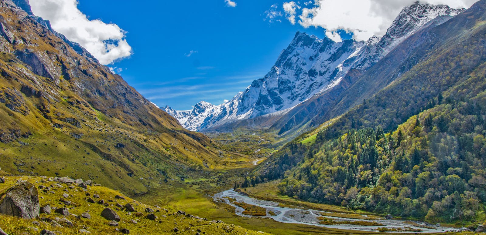
Trekking here will take you through a mix of thick shola forests with stream crossings, a carpet of beautiful grasslands. Added to this, the thrill of reaching the peak of Tadiandamol, trekking amidst the clouds is definitely something one must experience.
There is also an ancient palace used by the rulers of Coorg, at the base of the hill , which you can visit on your way back.
The trek will test your endurance, even if you are an experienced trekker. This trek can be done by fit beginners. However, go through the tips and detailed trek information to plan it out well.
➤ What to watch out for
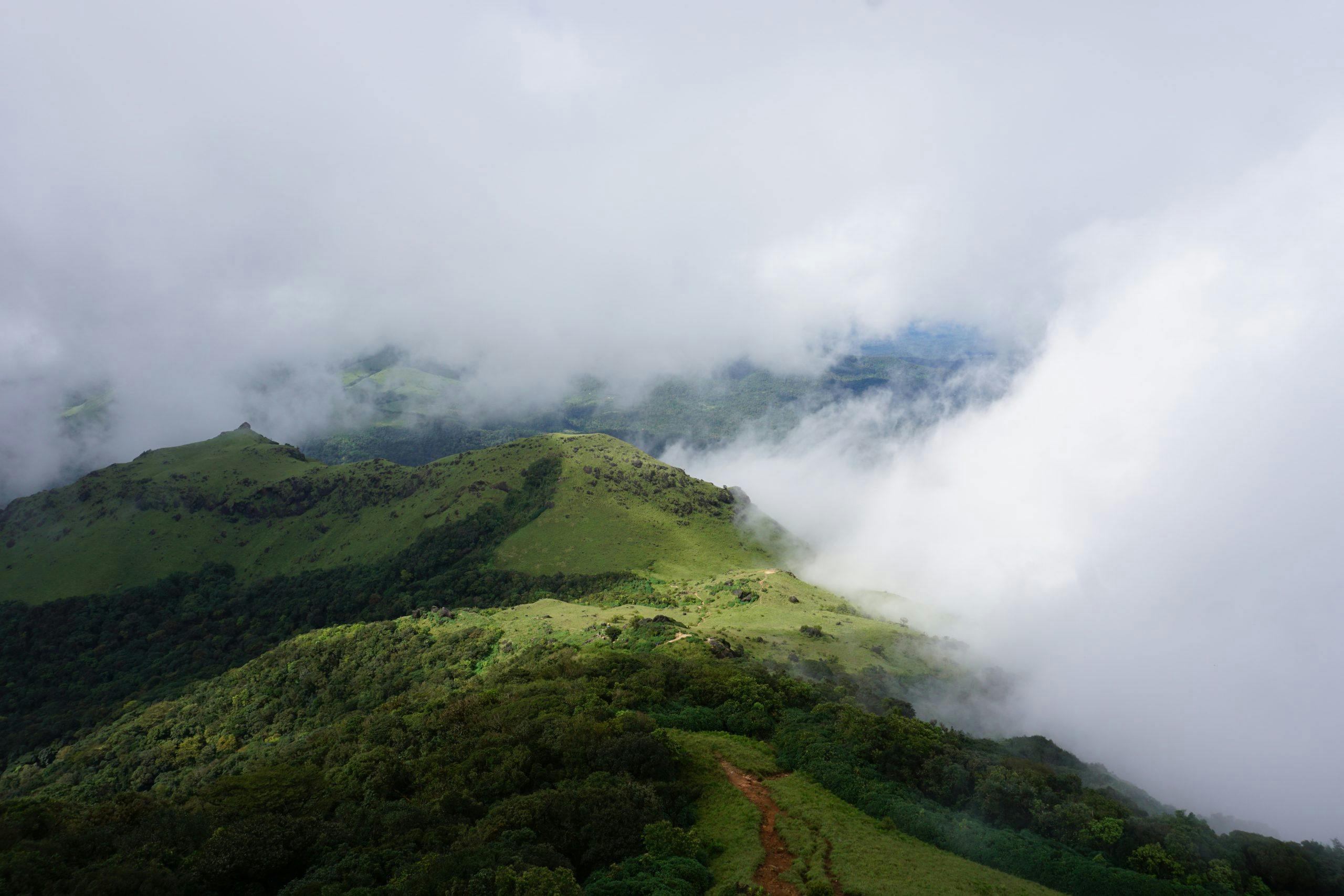
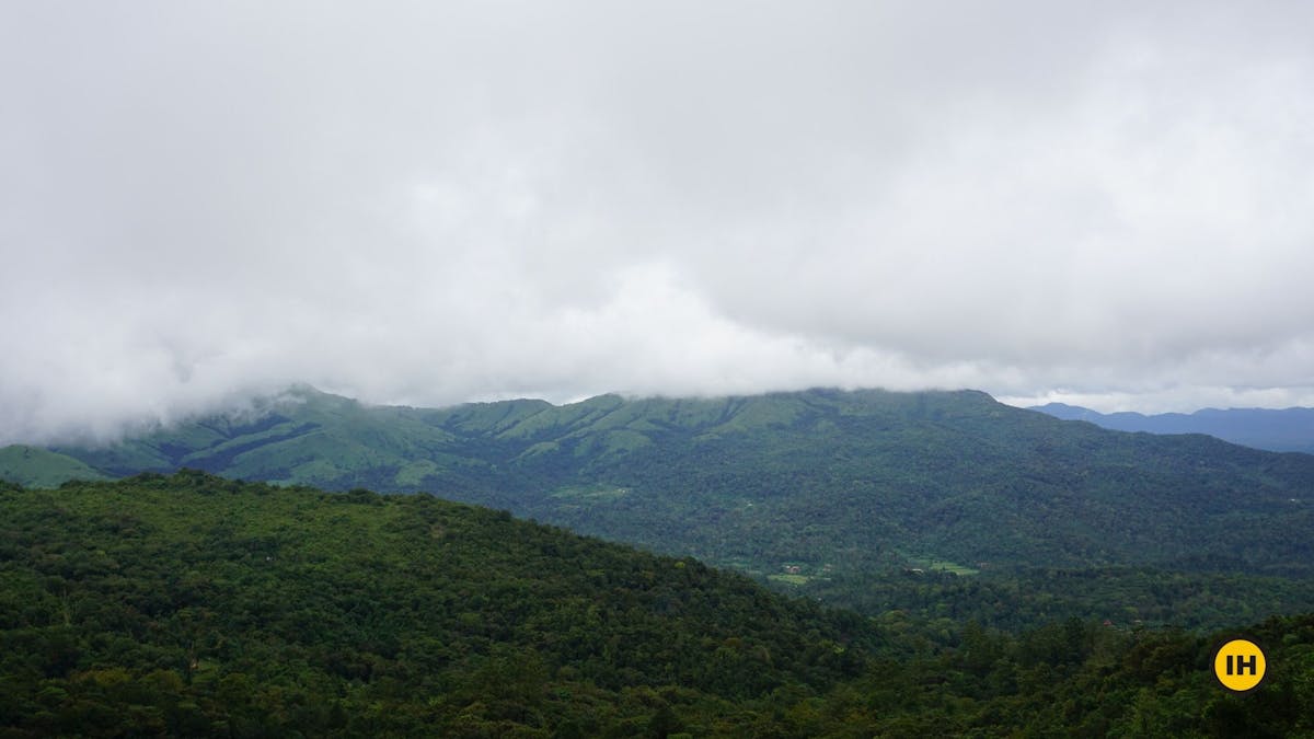
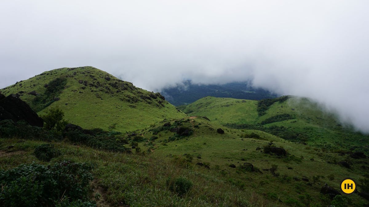
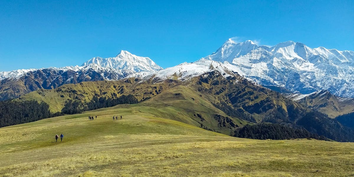
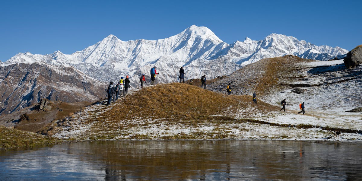
1. View of the Rolling Green Hills While Climbing to the Peak of Tadiandamol
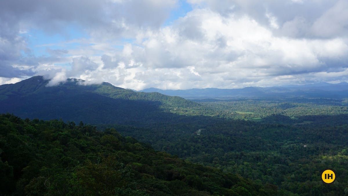
Standing at a height of 5,735 feet, the view from the peak is stunning to witness. You can see the green hills spread across as far as the eyes can see. This extends in all directions from the peak.
The valleys are filled with the evergreen forests.
View of the green hills stretched across all directions. You can see the patches of the Shola forest in between. Picture by Akshay K
Often this view is difficult to get during the monsoon and post-monsoon season when clouds cover the entire region. To get clear views, go just before the start of the summer season
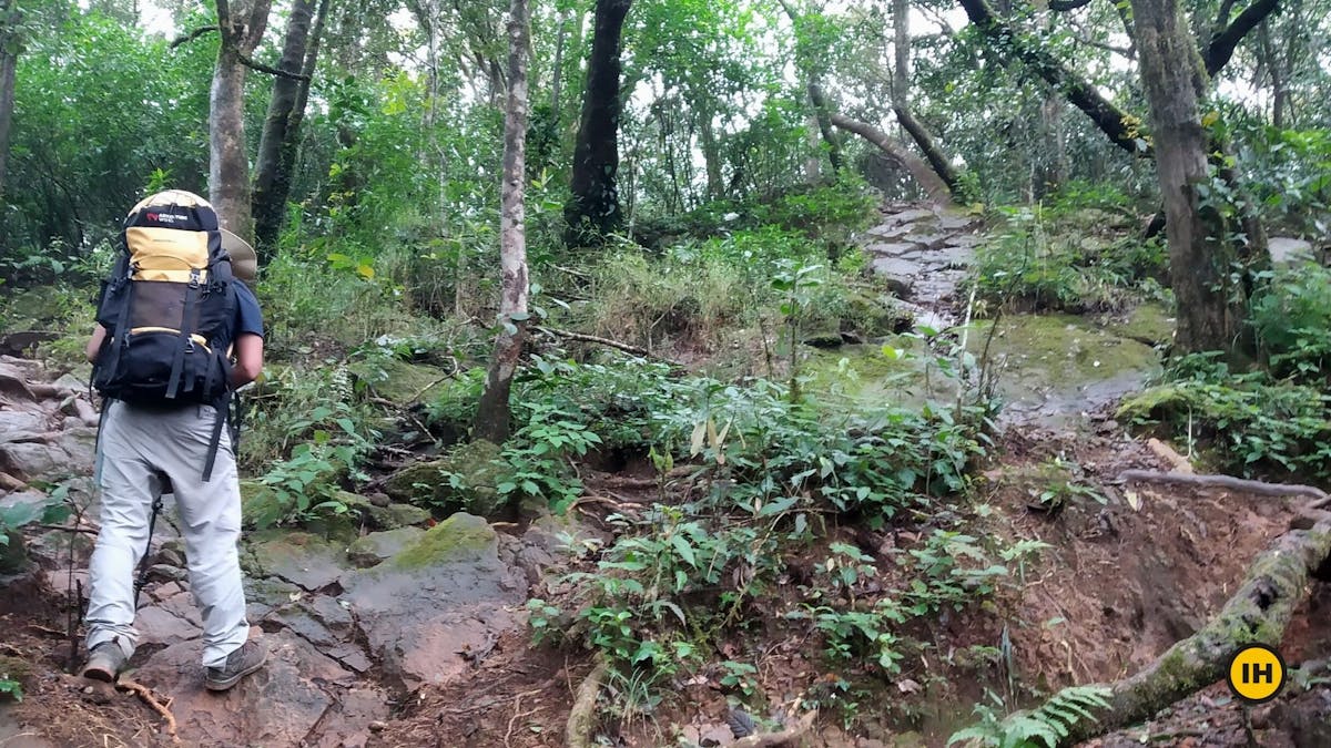
2. Trekking in the Splendid Evergreen Forests of Shola
The Shola forests are stunted tropical forests found in valleys amid rolling grassland in the higher mountain regions. The trek is a hotspot for various flora and fauna.
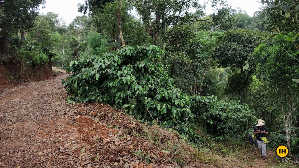
One can spot coffee estates and pepper plantations throughout this entire stretch of the trek. Along with these, you have the Arecanut (Betel nut) trees, Nutmeg trees, fishtail palms, and various other trees growing here.
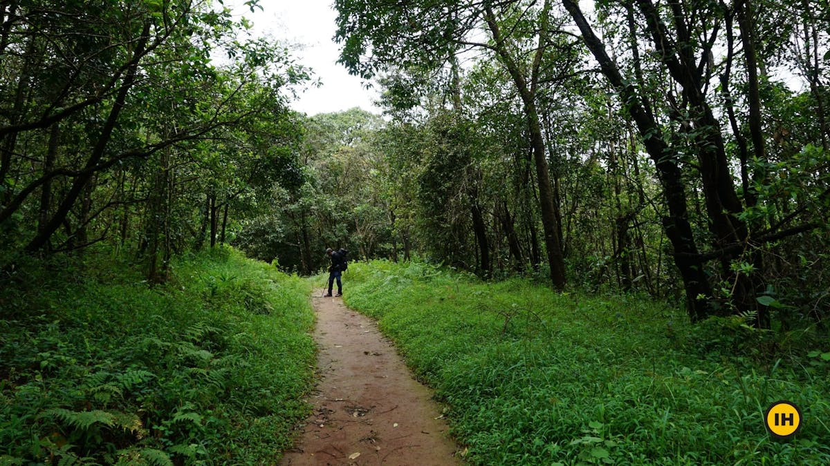
Trekking through the forest section. Picture by Suhas Saya
If you are a keen observer while trekking through the forest, you will definitely spot various millipedes, Calotes Versicolor lizards, many species of butterflies and if you are lucky, maybe even spot a snake slithering on its way across the trail. You will definitely have the company of leeches if you are trekking in the monsoon or post-monsoon season.

Suhas Saya
Head of DIY and Documentation Team
"Even though the Tadiandamol trek is very popular and a nice trek to do, I have a bone to pick here while comparing it with other treks in the same region. If there was a choice given to me, I would any day select the Kopatty Trek which starts from the Cherambane village. The rewards on the Kopatty trek are marvelous. A lesser-known trek amongst trekkers. It is easily the underdog that has more things to offer. Tadiandamol Trek having the title of being the highest peak in the Coorg district, usually takes up more space in the trekking circle."
➤ Trail Information
Tadiandamol Trek can be divided into four sections. If you are taking your own vehicle or a jeep/auto from Kakkabe, you can exclude the first section until the Nalknad Palace. The next three sections will be valid for you.
- Walk on the road from Kakkabe Bridge to Nalknad Palace
- A gentle ascent from Nalknad Palace to the Base of Tadiandamol
- Trek from Base of Tadiandamol to the Boulder point
- Climb from Boulder point to the peak of Tadiandamol
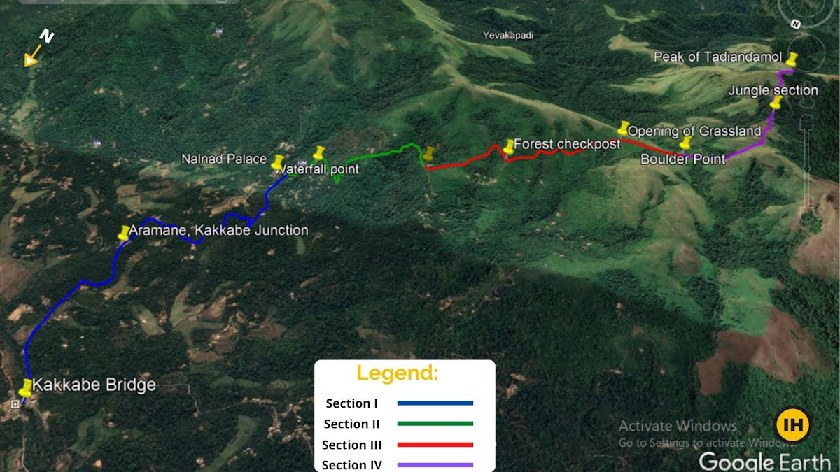
Trail Map of Tadiandamol Trek. Source: Google Earth. Picture Courtesy Suhas Saya
Section I: Kakkebe Bridge to Nalknad Palace
Trek Distance: 5.54 km
Trek Duration: 1 hour
GPS coordinates of Kakkebe Bridge: 12°15'22.1"N 75°38'36.0"E
GPS coordinates of Nalknad Palace: 12°14'07.7"N 75°38'23.7"E
Start your trek in the morning. If you have taken a local bus, it drops you at the Kakkabe bridge. If it's a bus going forward on the Virajpet-Talakaveri road, you have the option to get down at the junction of Aramane and Kakkabe saving 15 minutes of walk.
Otherwise, start your trek from the bridge, towards the Virajpet-Talakaveri road that continues to the East.
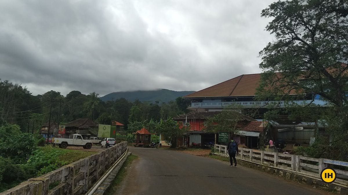
Starting the trek from the Kakkabe Bridge. Picture by Roshan Padhi
If you are unsure, just ask the locals around and they would point you in the right direction.
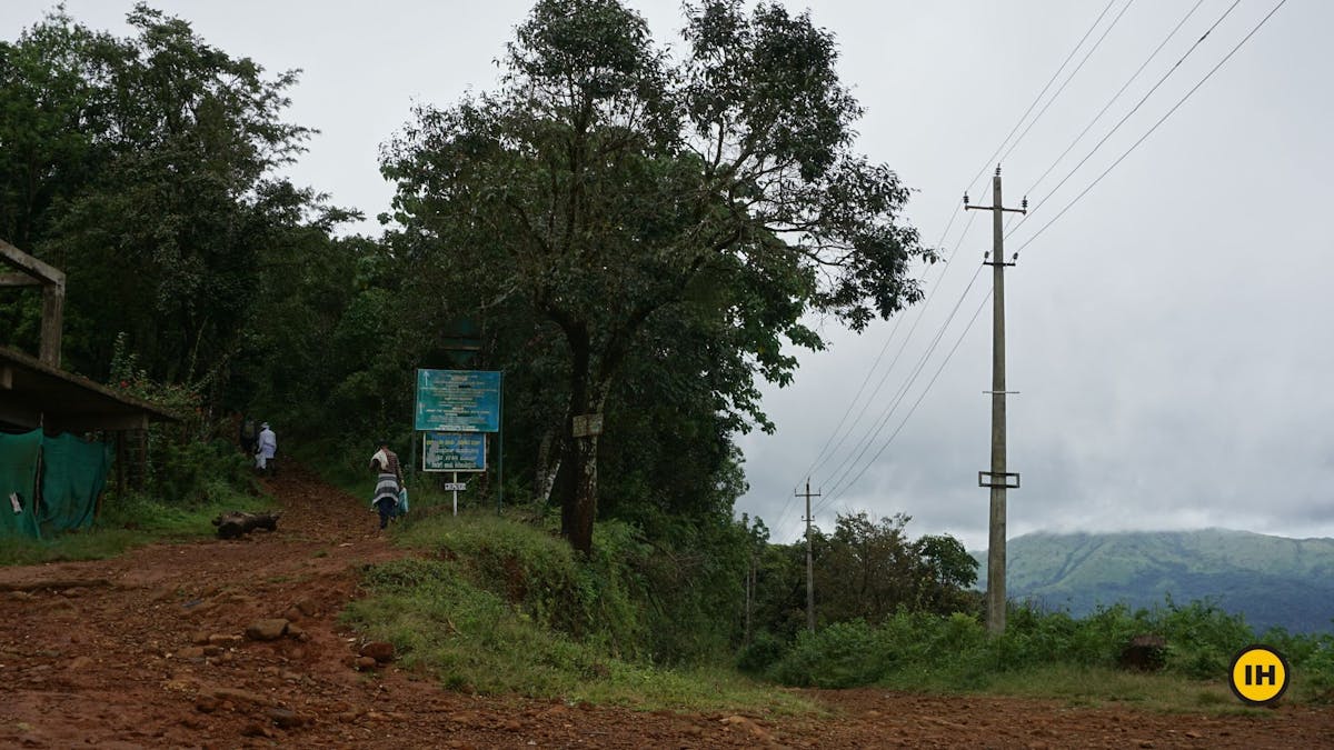
It takes about 15 minutes for you to reach the junction of Aramane and Kakkabe road head. You need to take the right which leads to the Nalknad Palace Road.
If you are not confident of your fitness and want to skip this first section, you have an option to do so. You won’t be missing out on much. Take an auto or hire a jeep from the bridge to Nalknad Palace. An Auto will cost you Rs 400 while a jeep costs Rs 750 to 800. You can also take a shared option if you see other trekkers starting from the bridge. It will save you one hour of walking through the 5.5 km road head to Nalknad Palace.
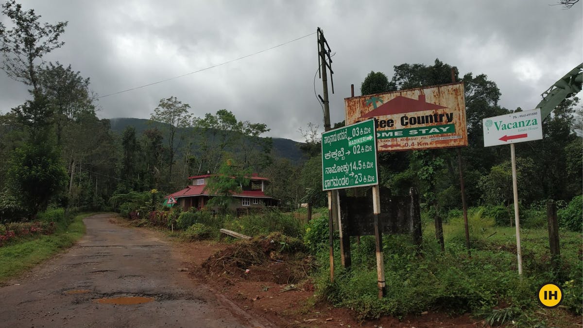
Junction of Aramane and Kakkabe Road. Notice the board saying the way to Nalkand Palace which is 3 km from here. Picture by Saurabh Sawant
From the junction, the road is straight forward until you reach the Nalknad Palace. A vehicle can easily go up until the Nalknad Palace. If you are using your own vehicle, you can skip to the next section or read more about how to reach and then come back.
Initially, you will come across a number of cottages and resorts/homestays on this road, around 5 to 6 of them. If you are planning to stay for a night here after the trek, you can book before going up on the trek.
Initial section through the greenery and estates. Picture by Saurabh Sawant
Keep your eyes and ears open while trekking here to spot various flora and fauna.
One can spot pepper and coffee plantations throughout this entire stretch of the trek. Along with these, you have the Arecanut (Betel nut) trees, Nutmeg trees, fishtail palms, and various other trees growing in the farmlands.
Trekking the early morning also adds to the chirping of birds.
The road to the left leads to Nalkand Palace. Skip this and continue ahead on the road. You can visit the palace on your way down. Picture by Suhas Saya
Zigzag roads and trekking for about 40 minutes to reach the Nalknad Palace. Visit this historical palace on your way down post trekking. You don't want to waste time exploring this on the way up.
Until early 2020, this was the last place where vehicles can go. Recently concrete blocks were being laid out until the base of Tadiandamol. If that gets done, the vehicles can go all the way up till the base.
Section 2: Nalknad Palace to Base of Tadiandamol
Trek Distance: 2 km
Trek Duration: 55 minutes
GPS coordinates of Nalknad Palace: 12°14'07.7"N 75°38'23.7"E
GPS coordinates of Base of Tadiandamol: 12°13'54.9"N 75°37'48.9"E
The trek now takes a more gentle ascent through a mud and gravel section from the Nalknad Palace to the base of Tadiandamol, where the actual trekking trail starts from.
Do not miss the waterfall when you are about to start the trek from Nalknad Palace. If you are trekking in the monsoon or the post-monsoon season, watch out for this unknown waterfall just 5 minutes into the trek.
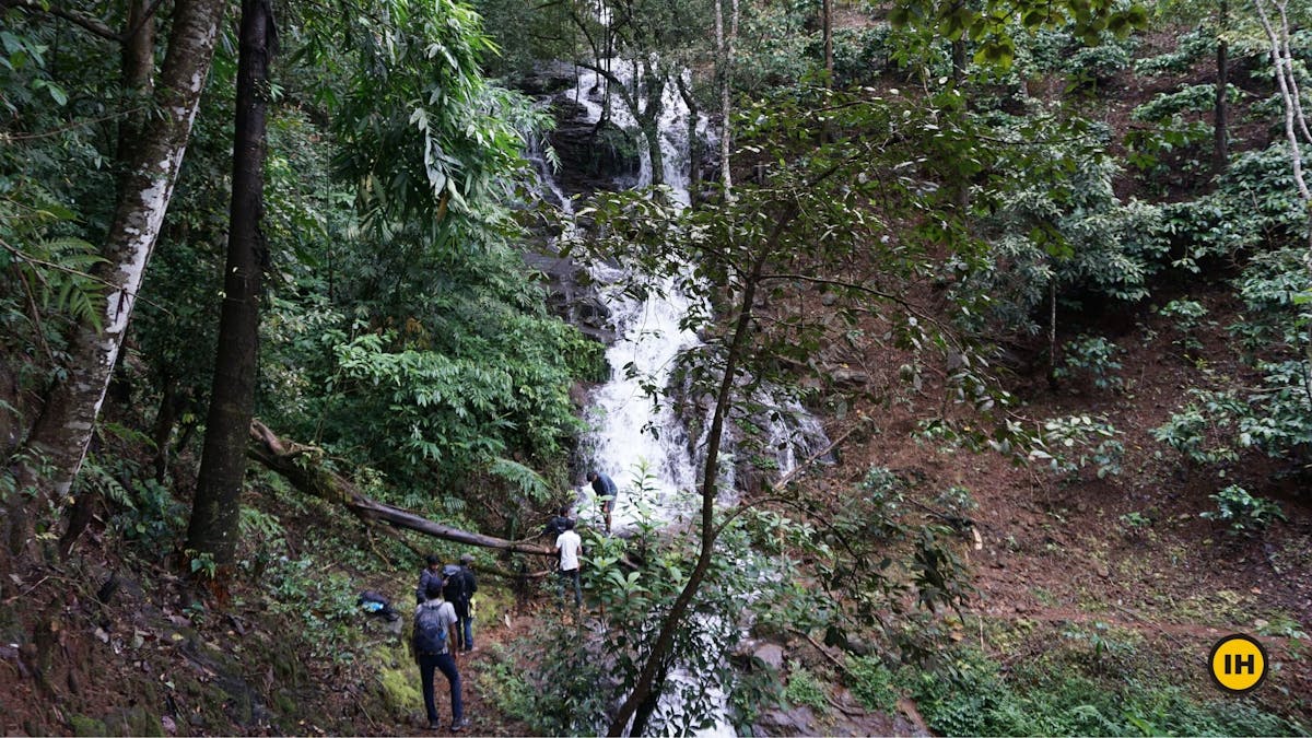
Waterfall near Nalkand Palace on the Tadiandamol Trek. Picture by Suhas Saya
We have marked this on the GPX file as well so that you don't miss this spot. So don't forget to download the file if you want to visit this hidden gem.
Coming out from the waterfall section to the main trail. Picture by Saurabh Sawant
Explore this section for a few minutes and head back on the main trail of the trek.
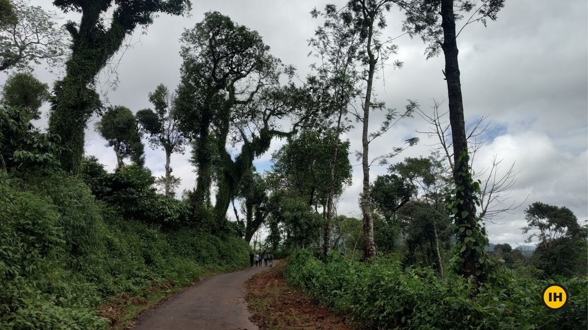
You will have a mix of broken tar road, muddy trail with small gravel, and concrete roads starting from here. The trek again takes you through green lush vegetation for about an hour.
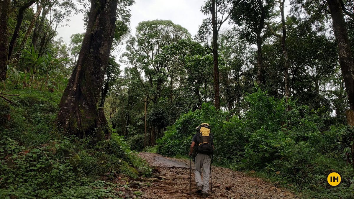
Trail with gravel, broken tar road through lush vegetation. Picture by Saurabh Sawant
Half an hour into the trek, you find this last house where a small stream runs by the side of it. You can refill your water bottle here.
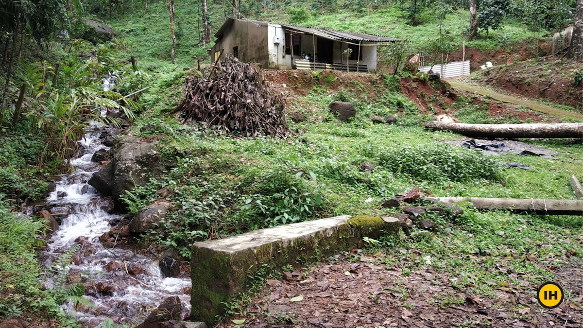
Last house before the base of Tadiandamol. Picture by Saurabh Sawant.
The base of the Tadiandamol is just 10 minutes away from this spot. Watch out for the viewpoint on the right to see the entire region opening up right in front of you.
Viewpoint from the base of Tadiandamol Trek. Picture by Suhas Saya
Section 3: Base of Tadiandamol to the Boulder point
Trek distance: 2.30 km
Trek duration: 1 hour 20 minutes
GPS coordinates for base of Tadiandamol: 12°13'54.9"n 75°37'48.9"e
GPS coordinates for the boulder point: 12°13'33.2"n 75°36'51.4"e
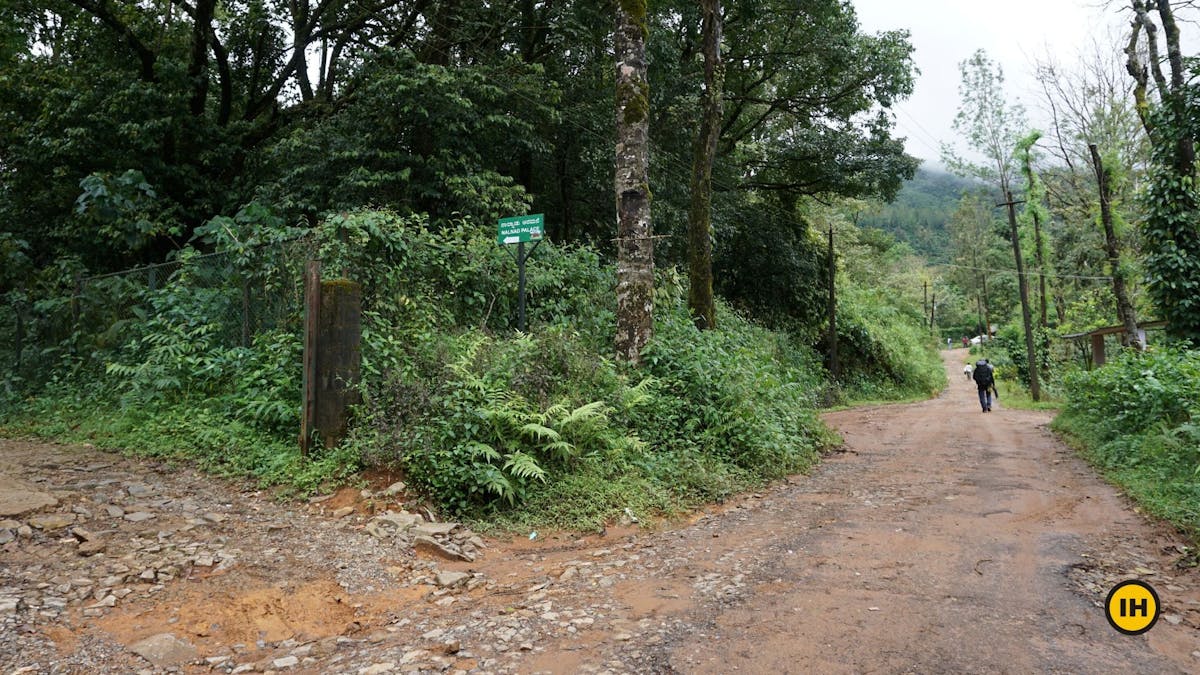
At the base of the Tadiandamol trek, you see two trails. there is one going on the left and the other on the right. you have to take the trail ascending on the left here.
Take the left trail to the Tadiandamol Peak. Picture by Suhas Saya
Do not take the trail on the right which leads to a few farmlands and houses.
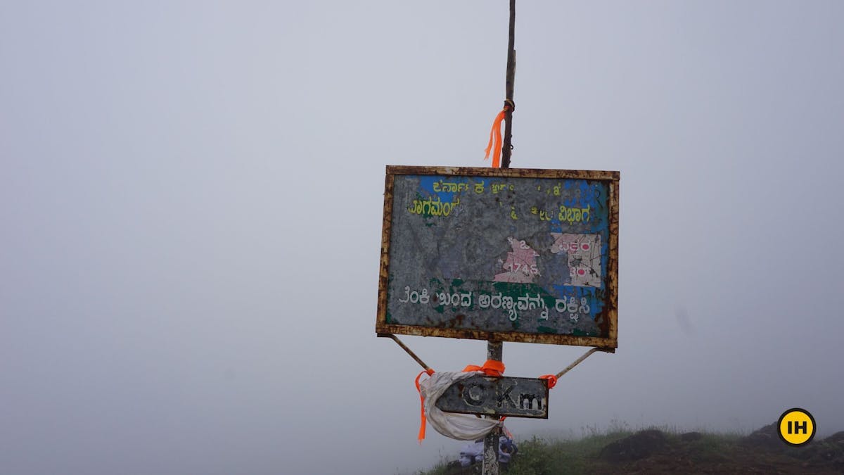
Notice a green board from the forest department which points to the left where the ascent starts. The board is slightly old and rusted. It points up marking 3.75 km left for the peak.
The trail from here onwards is a proper mud trail all the way.
About 15 minutes to your ascent, you will have your first stream crossing. We suggest you remove the shoes and socks to cross this stream. The shoes can get wet otherwise and ruin your trek later. Trekking in damp shoes or socks is no fun. The water will be more than your ankle. If you are trekking during the monsoon, it will be even higher.
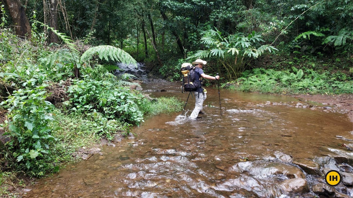
First Stream Crossing on the Tadiandamol Trek. Trekking Poles help get balance while crossing the stream. Picture by Saurabh Sawant
Leeches start from this area and continue all the way until the grassland section on the trek. You have now entered the thick of the Shola forest.
| Tip: Apply Dettol or Savlon at the base of Tadiandamol to avoid leeches if you are scared of leeches. If you are not too worried, the best option is to remove once you reach the grassland or summit. A few leeches sucking some of your blood won't do any harm.
Close to 200 meters after the stream crossing, you have the forest check-post. Each individual has to pay Rs 50 to proceed further. The forest officer will check your bag for plastic items that you are carrying. Any liquor or unwanted things will not be allowed on the trek and will be confiscated. Do not carry them in your bag.
Forest Checkpost on the Tadiandamol Trek. Picture by Saurabh Sawant
After the entry is done with your name, contact numbers, you can proceed further on the trek.
Note: You cannot trek past the forest check-post after 2:30 pm
Keep your eyes to the right side when trekking. The view opens up suddenly. Often, the clouds cover up the entire valley to the right. If the sun is shining and you have a clear day, you see the valley in lush green and hills starting to pop out.
Views starting to open up. Picture by Suhas Saya
You will have a second stream crossing coming up soon. This stream crossing is smaller than your first one. Looking at the depth of the water, you can think of crossing either by removing your shoes or not.
Once you cross, try to spot a small milestone saying 2 km left for the peak on your right. It can be hidden by overgrowth as well. It's more like playing a game of spotting this stone.
Trek for another 20 more minutes to cross the forest section. The canopy of trees starts to fade out and you have now entered the grasslands.
Your next stop is about ten minutes away from the boulder point.
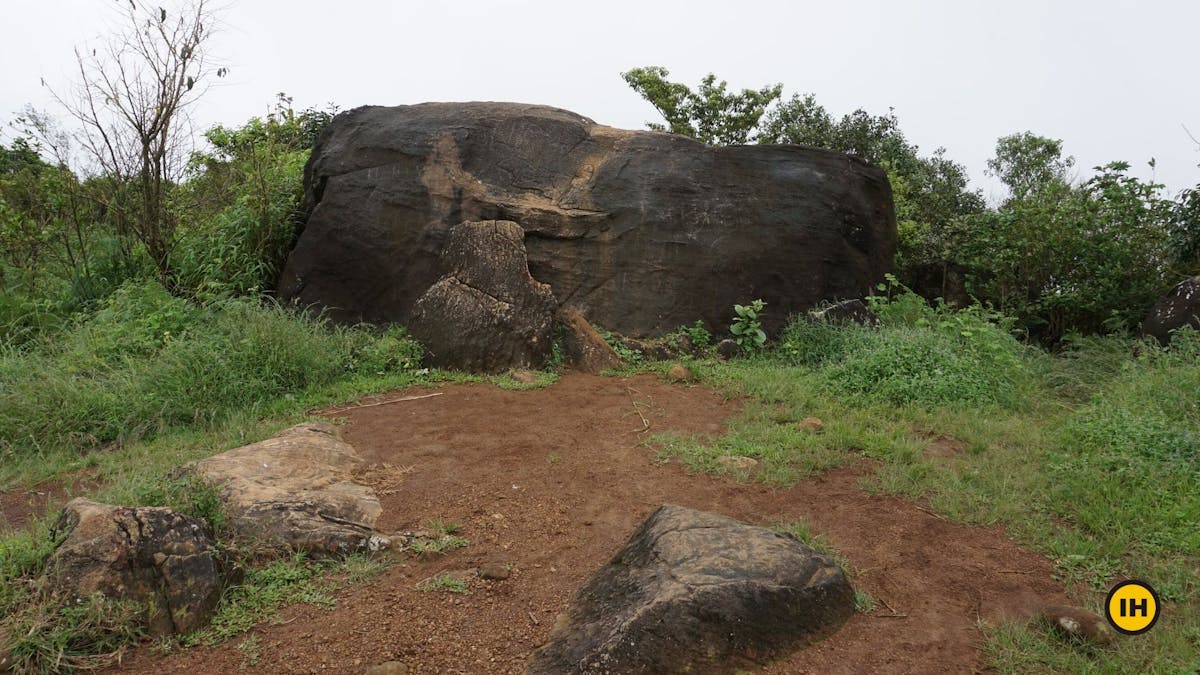
Big Rock Point on the Tadiandamol Trek. Picture by Suhas Saya
Take a small break and hydrate yourself. The last section of the trek to the peak is remaining which will be your maximum ascent.
Section 4: Boulder point to Peak of Tadiandamol
Trek distance: 1.68 km
Trek duration: 1 hour 15 minutes
GPS coordinates for the boulder point: 12°13'33.2"n 75°36'51.4"e
GPS coordinates for the peak of Tadiandamol: 12°13'02.4"n 75°36'31.8"e
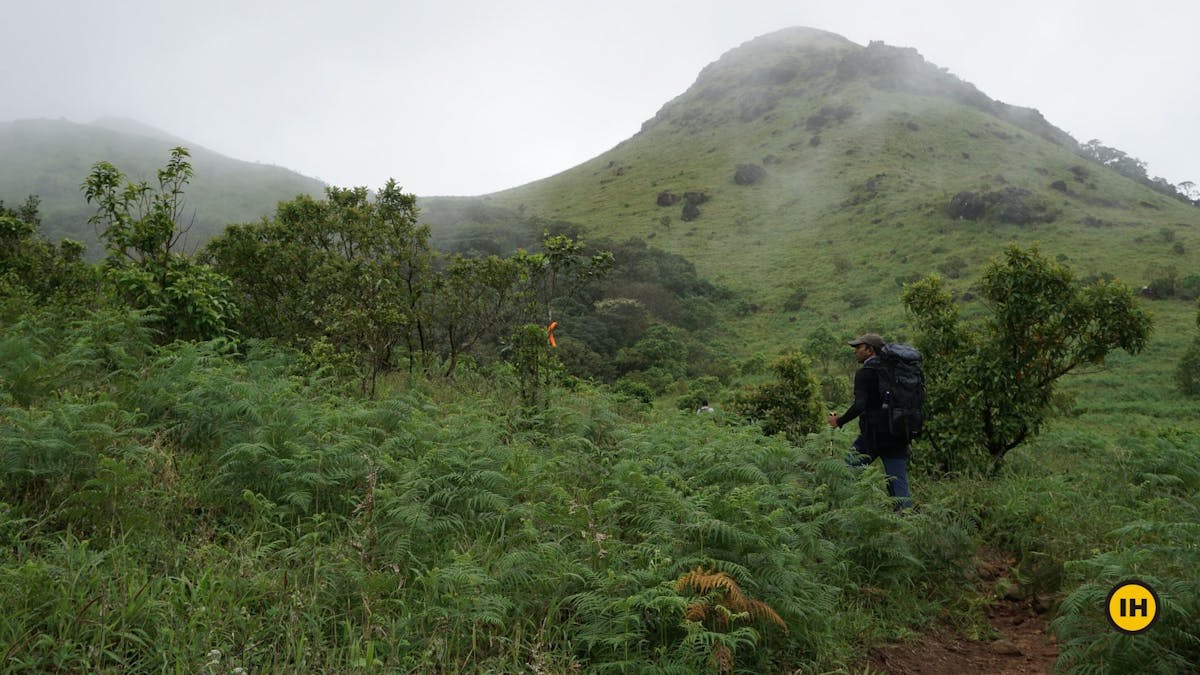
From the boulder point, you see a hillock. This is a false peak and not the actual peak of Tadiandamol. The peak of Tadiandamol is much further and towards the left or the southern side facing the false peak.
Begin your ascent following a well laid out trail in front of you. The majority of time, mist and clouds cover this last section.
Trekking through the mist and clouds is a beautiful experience. You will find orange ribbons tied on trees by the forest department which act as markers on the trail. If you spot this ribbon, you are going on the right trail.
Start noticing the Orange Ribbons placed as markers on the trail of Tandiandamol Trek. Picture by Suhas Saya
Around 20 minutes trekking with a moderate climb, you get to a point resembling a fort structure. Past that, follow the trail, and keep to your right.
There is one fork that can put a thought in your mind. Either look for the orange ribbon or keep to the trail on the right.
Take the trail to the right. Picture by Suhas Saya
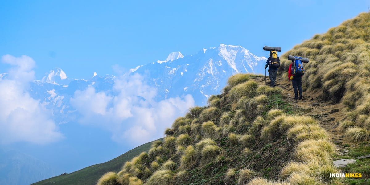
There are a couple of viewpoints sections that you can take a couple of breaks to soak in the views. Spend a few minutes looking back at the green rolling hills as you climb up.
Take a few sips of water. You are now going to enter the second forest section from here.
Don't forget to look back every now and then while climbing up the slope. Picture by Suhas Saya
The trail here is much more slippery and uneven. Watch your footing and take the support of trees as you ascend for another 10 minutes through the forest.
| Tip: A trekking pole is extremely helpful. Carry two trek poles to help you on the trail. To know more about how to use a trekking pole, go through this video.
Second Forest Patch. Picture by Roshan Padhi
Once you cross this forest section, you are left with one final push to the peak of Tadiandamol. It takes about roughly 20 to 25 minutes to reach the top.
If you are trekking in a group and if the weather is not good, stay close. The visibility can reduce to less than 50 meters.
There is a pole erected with a board saying you are at the topmost point of the Tadiandamol hill.
You are at the top of the Tadiandamol hill when you see this pole with the board. The backdrop is entirely covered with mist. Picture by Suhas Saya
You can expect a light drizzle on the top since you are at an altitude of 5,375 feet. Mist formations and whiteouts are common. So watch out and cover your electronic devices well.
Spend about half an hour having your lunch and trying to be patient about getting the views from the peak.
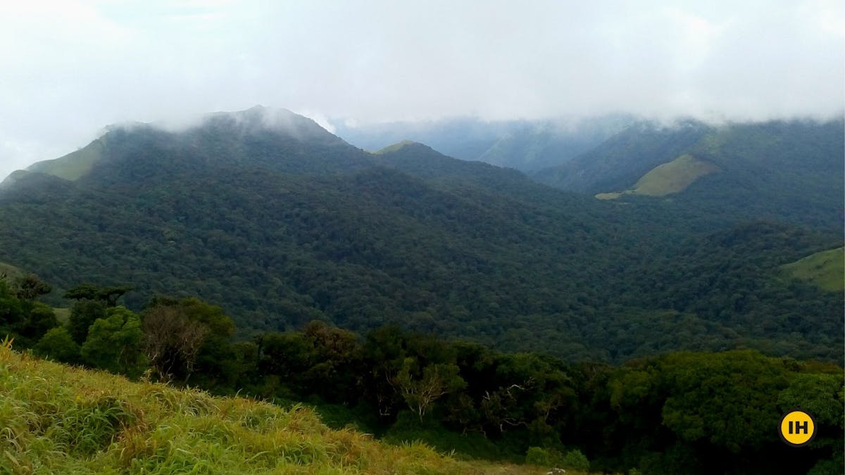
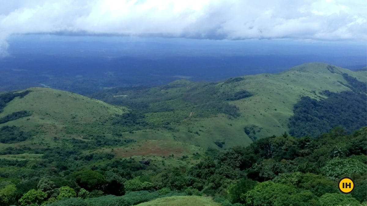
View on the other side of the mountain from the peak. Picture by Akshay K
About the Descent from the Peak:
The descent will follow the exact same route that you have taken to the way up. It will take you close to 3 hours to descend down to Nalknad Palace.
Add another hour if you are going down all the way to Kakkebe. The last bus from Kakkabe to Bhagamandala and Virajpet leaves at about 6 pm.
Click here to go back to the table of contents
➤Best Season to do the Tadiandamol Trek
The best season to do Tadiandamol trek is from September to February.
Post monsoon, you will witness the lush greenery of the region of Coorg in its full glory. The trek can be extended till the pre-summer season when the most part of the trek has a mix of brown and green. You will have much clearer views compared to the monsoon season.
The summer season is prone to wildfires. Hence trekking is not allowed and banned during the peak of the summer season (April to June)
The region receives heavy rainfall during the monsoon season. If you want to take this up as a monsoon trek, be ready with all the right gear. The difficulty of the trek also increases if you go during the peak of monsoon.
Click here to go back to the Table of Contents.
➤ How Difficult is Tadiandamol Trek
The Tadiandamol trek is of Moderate difficulty.
Your endurance will be tested if you are trekking from Kakkabe to Kakkabe in one day. One way, the trek will be close to 12 km. So covering close to 23 to 24 km in a single day can test even the fittest trekker.
There are no difficult sections as such but note down a few things to keep in mind while trekking.
- Trekking in the forest section can be slippery.
Make sure you wear proper trekking shoes and carry two trekking poles with you. - Crossing the two streams in the forest section can be a bit tricky.
Watch out for the rocks covered with moss. Any small twists or sprains will be difficult to endure or evacuate on the trek. - The final stretch to the peak of Tadiandamol will be very slippery in case of rains.
So if you are trekking during monsoon season, take extra precautions.
Trekking Poles on the trek along with GPS is highly recommended.
Click here to go back to the Table of Contents
➤ How Can I Go To Tadiandamol From Bangalore
The Tadiandamol trek starts in a small village called Kakkabe.
This is about 25 km from Virajpet, one of the main towns of the Virajpet district of Madikeri, Karnataka. Virajpet is also on the borders of Karnataka-Kerala.
Reaching Tadiandamol by your Own Vehicle
If you are planning on reaching Kakkabe using your own vehicle from Bangalore, you can use this link to help setup navigation in google maps.
You can actually take the left turn at the junction of Aramane and head towards the Nalknad Palace if you don’t want to reach Kakkabe village.
For a more detailed explanation, read through the information below.
Take the Bangalore-Mysore highway from Bangalore. Cross Mandya and look for the KRS road and avoid going inside the main town of Mysore. This circle to the KRD road comes just after the Srirangapatna bridge. In the circle, you need to take the right.
Your target from here would be going to Virajpet first. The drive takes you through lovely small towns and villages. Go past Bilikere and you will reach Virajpet soon.
From Virajpet, head towards the Virajpet-Byndoor road. At the Kadanoor junction, take the left which now takes you on the Virajpet-Talakaveri road.
From the Kadanoor junction, the drive takes you through some lovely periphery of the Brahmagiri Sanctuary. Be careful while driving on these roads and you will enjoy this whole drive until you reach either the sharp left turn of Aramane junction or the village of Kakkabe.
Reaching Tadiandamol by Public Transport System
The base village Kakkabe is slightly difficult to reach compared to other base villages on most of the treks. However, you can still reach Kakkabe by 8 am if you are taking a bus from Bangalore.
Go through the details here. There are many buses from Bangalore to Virajpet that can be booked online at KSRTC website.
Buses for Virajpet usually leave from the Satellite bus stand. Take a bus which leaves a bit late in the night. A bus leaving at 11.30 pm reaches Virajpet at 5 am in the morning.
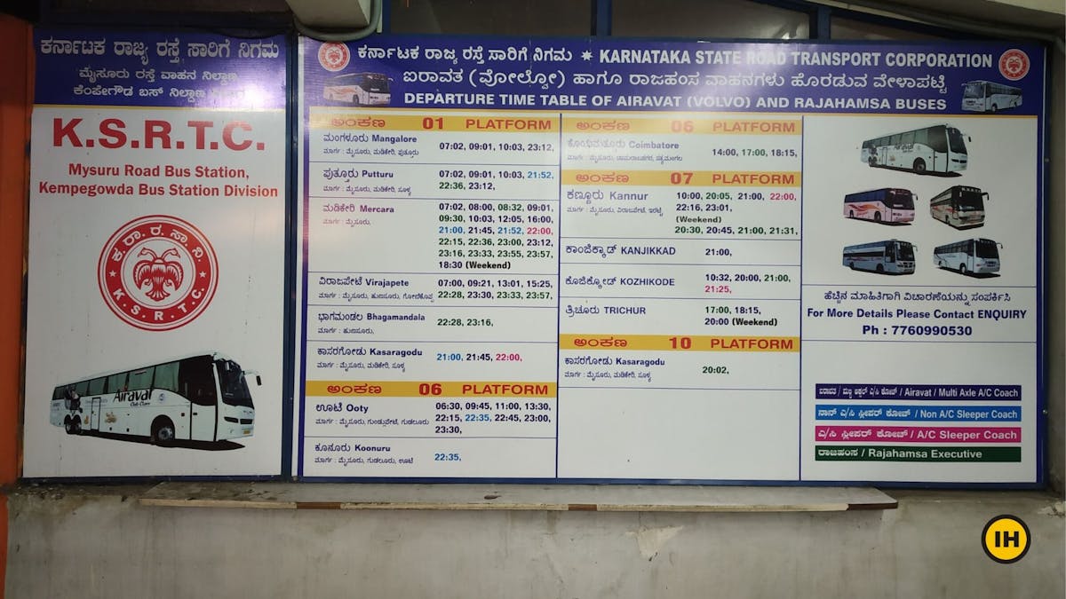
KSRTC Bus Timings Chart from Satellite Bus Stand. Picture by Saurabh Sawant
From Virajpet, there are a few options to consider. At the bus stand, you will see a few taxis and autos waiting in the morning. A direct taxi or a cab to Kakkabe costs Rs 900 while the Auto will charge Rs 450.
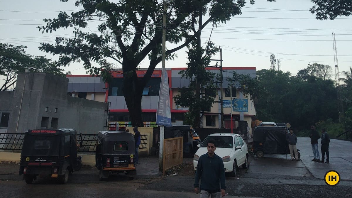
Virajpet Bus Stand early in the morning. Picture by Saurabh Sawant
You can still wait and take a more budget-friendly option. It will cost only about Rs 60 per person if you take a bus to Kakkabe.
We recommend waiting for the local bus and enjoying the minimal way of reaching Kakkebe. The experience is unique.
There are times when the bus journey reminds you of the Knight Bus from the Harry Potter and Prisoner of Azkaban. No seat belts to fasten here. It is definitely a fun and bumpy ride!
Local buses to Talacauvery ply from Virajpet after 6 am. Take a bus which either goes to Napoklu or buses going to Bhagamandala. A bus going to Bhagamandala directly would be the best option since this bus will go via Kakkabe.
If you have missed this bus or want to head towards a closer village to get more connecting buses, then Napoklu is your other option.
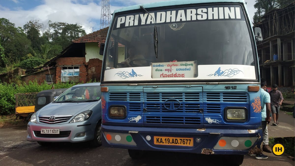
Local bus from Napoklu to Kakkabe. Picture by Saurabh Sawant
On Sundays, however, there are limited local buses and start only after 6.45 am from Virajpet. You can still make it to Kakkebe by 9.30 am.
On the return, the last bus from Kakkabe to Bhagamandala leaves at around 5.45 pm and for Virajpet, there is a local bus that usually leaves at about 6 pm.
Nearest International and Domestic Airport
Mangalore International Airport - 175 km
Mysore, Domestic Airport - 150 km
Click here to go back to the table of contents.
➤ Frequently Asked Questions about the Tadiandamol Trek
1. Do I need Permission for the Tadiandamol trek?
You need to take permission on the trek of Tadiandamol. The trek falls under the Bhagamandala Range Forest of the Brahmagiri Wildlife Sanctuary. You will find the forest check post on the trail while trekking.
The entry fee is Rs 100 per person.
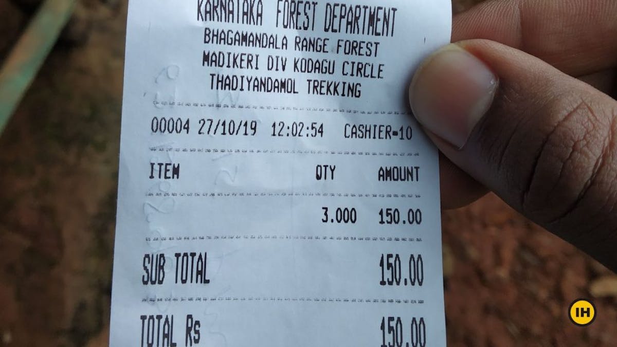
Forest fee on the Tadiandamol Trek. The fee has changed to Rs 100 per person from Oct 2020. Picture by Saurabh Sawant
2. Is camping allowed on the Tadiandamol trek?
No. Camping on the Tadiandamol trek is not allowed. Trekkers were able to camp inside the forest, close to the big boulder point until 2016. However, due to sightings of elephants and other wild animals, camping has been stopped on the Tadiandamol Trek.
3. Where can I stay on the Tadiandamol trek?
If you want to stay overnight, there are quite a few options before the start point of the trek. You have a few Airbnbs, Oyo rooms, homestays, and even a few resorts for you to select from.
| Tip: Select a place after the junction of Aramane and Kakkabe. You find about 4 or 5 cottages on the main trail towards Nalknad palace.
Here is one reliable contact number of a homestay, Kumaranna - 9880214433
Finish the Tadiandamol trek by evening and head towards Bagamandala for the night stay. You can find more budget-friendly hotels for one night stay which would cost less than Rs 800.
As a bonus, you can also think of combining this trek with the Kopatty trek in the Cherambane village of the Virajpet district. Buses start from Bhagamandala at 6.15 am and head to Cherambane.
4. Is there any time restrictions on the Tadiandamol trek?
Trekkers are allowed to trek between 6 am and 6 pm on all days. However, post 2:30 pm, you are not allowed to trek past the forest checkpoint.
The best time to start your trek will be early in the morning or before noon. This will ensure you are back to the base of Tadiandamol or Kakkabe before dusk.
It is not advisable to start your trek in the afternoon. When the sun sets in the evening, it gets harder to reach the base of Kakkabe.
5. What are the Food and Water source on the Tadiandamol Trek?
Kakkabe is your last reliable source for food. You will find a small hotel. Nothing fancy or a big restaurant close by to the trek.
There is also a small eatery about half a kilometer from the junction of Aramane and Kakkabe on the trail. However, this is not reliable.
For water sources, if you are trekking in the monsoon or post-monsoon season, you will find two streams and also a waterfall on the trail. This is clean, freshwater is flowing down. You can fill your bottle from there.
The other option is to fill two bottles of water in Kakkabe town.
| Tip: If you are not comfortable with having water from the stream or the waterfalls, carry purification tablets or a life straw bottle to purify the water.
6. How long is the Tadiandamol trek?
The Tadiandamol trek is close to 12 km one way. It takes about four and a half hours to reach the peak. And it takes about 3 hours to descend back to the base.
7. Where is Tadiandamol peak?
Tadiandamol Peak is located in the Kodagu district of Karnataka. The base of the trek is a village called Kakkabe. It's the highest peak in Coorg and the third highest in Karnataka.
8. What is Tadiandamol famous for?
Tadiandamol is famous for the rewarding views from the top. There is also a palace, which was used by the ruler of Coorg at the base of the hill.
Emergency contacts for Tadiandamol Trek
Hospital: Virajpet Government Hospital (Contact Number - +918274257324) and Bhagamandala General Hospital are the nearest hospitals on the Tadiandamol trek.
Both these hospitals are about 25 kilometers away from the Kakkabe town.
Police Station: Napoklu Police station (9480804948, 08272 237240) and Virajpet Police Station (+918274257333) are the nearest police stations to the Tadiandamol Trek.
Bhagamandala Forest Department: In case of any emergency, you can contact the forest office of the Bhagamandala Forest division.
ERSS: For any kind of emergency help, you can contact the Pan-India Emergency Response Support System (ERSS) number- 112
ATMs and Network on the trek
ATMs: Virajpet and Napoklu are the towns having the nearest ATMs. It is better to carry cash with you than rely on any ATMs on the way. Carry cash either from Bangalore or at a reliable town en route if you are driving till the base.
Mobile Networks: You get good coverage of BSNL and Jio through various patches on the trek. The signal connections are intermittent, however. Do not depend on them during the monsoon season.
Vodafone does not get good connectivity throughout the trek
➤What To Pack For Tadiandamol Trek
- Basic First Aid kit*
- Identity Card
- Cap/ Scarf/ Bandana & Sunglasses
- Water (Minimum two litres)
- Lemon and salt OR Electrolyte Powder/Drink (Electral/Gatorade/Glucon D, etc.)
- High-calorie snacks (Nuts & dry fruits, home-baked cake, etc.)
- Safety Pins, Rubber bands & Whistle (Useful in emergencies.)
- Quick Dry T-shirts are preferable over cotton tees.
- Poncho, only during monsoons
- Plastic sheet to wrap electronic devices, only during monsoons
- Sunscreen (SPF 50+)
- Optional: Trekking poles
*First aid kit:
- Scissor
- Band aids (Regular & Waterproof)
- Analgesic spray (Relispray, Volini, etc.)
- Antiseptic Liquid (Savlon, Dettol etc.)
- Antiseptic powder (Povidone-Iodine based powders like Cipladine, Savlon, etc.)
- Cotton roll & Bandage
- Crepe Bandage
- 1 inch wide medical tape (paper or cloth.)
- Micropore tape
- Tablet for motion sickness (Avomine), Acidity (Gelusil, Digene, etc.).
- Mild pain relief tablet (Crocin)
| Note: Always consult a doctor before taking any medicine.
➤ Places to Visit Near Tadiandamol
Bhagamandala: Bhagamandala is situated on the river Kaveri in its upstream stretches. A pilgrimage place considered sacred for a river confluence in the Kodagu district.
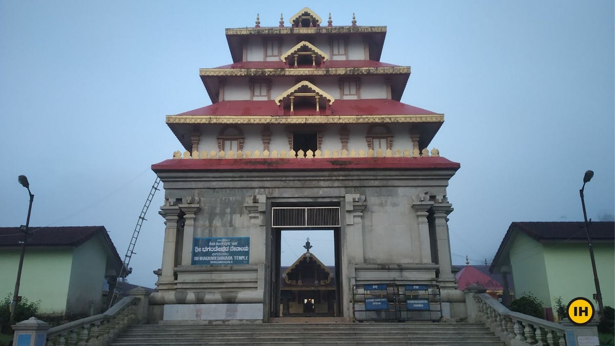
Sri Bhagandeshwara temple in Bhagamandala. Picture by Saurabh Sawant
At this place, the Kaveri is joined by two tributaries, the Kannike and the mythical Sujyothi river.
Madikeri/Coorg: Located on the Eastern side of the Western Ghats, Madikeri, or formerly known as Coorg is a hill town. The district of Madikeri gets many tourists for its coffee plantations and pleasant weather throughout the year.
It is home to Talakaveri, where the River Kaveri (Cauvery) originates from the Brahmagiri Hills, which can be a trek done along with the Tandiandamol.
Kopatty Trek: A trek close by to Tandiandamol Trek. The Kopatty trek in the Cherambane village of the Virajpet district can be combined with this one and made into a two-day journey. Stay at Bhagamandala for the night. Buses start from Bhagamandala at 6.15 am and head to Cherambane. You can cover both the treks and take a pick on which one you like more.
Nishani Motte Nishani Motte is a beautiful trek very close to Talacauvery, the birthplace of the river Cauvery.
➤ Trek Contribution
Trek done and documented by Saurabh Sawant, Roshan Padhi, Suhas Saya.
Special thanks to Akshay K, Saurabh Sawant, Roshan Padhi, Suhas Saya for the pictures of the trek.
Banner Image by Suhas Saya.
The trek was written by Suhas Saya.
GPX File Opt in
We go to great lengths to ensure you have a safe trek. So here’s a GPX file of the trail to help you navigate without getting lost.